As summer draws to a close, so do our excavations at the Dead Shed, located behind the Nathalie P. & Alan Voorhees Archaearium. While exploring the final test unit, we discovered more of a modern utility line and a few historic fence posts. The fence line runs east/west and likely relates to the 19th or 20th-century agricultural activity in the area. Now that excavations are wrapping up, we are double-checking our paperwork, digital maps, and photos to ensure everything is complete. We also used photogrammetry to create 3D models of the excavation area. Once we are satisfied with our recording, the open test units will get filled back in. Afterward, Dead Shed construction can begin, avoiding the newly located features.
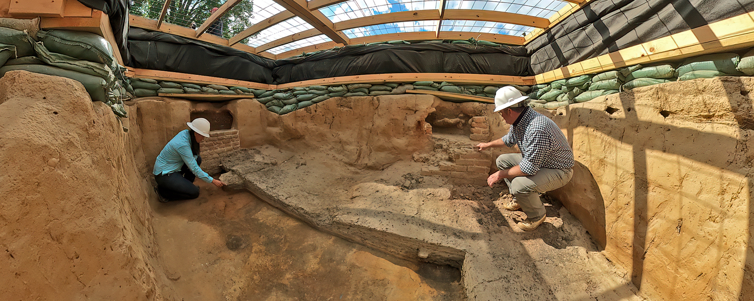
Excavations near the Fort’s East Bulwark are finally starting to uncover intact 17th-century deposits. Although we are still removing modern overburden layers and uncovering utility lines, the team is also seeing greater numbers of historic artifacts. Some cool examples of things that we have found include glass from wine and case bottles, ceramics from Europe and Virginia, pipe stem and bowl fragments, and a high concentration of large animal bones. Some of the bones exhibit butcher marks, which are cut marks left by knives and saws used to process the meat.
One of the layers excavated near the East Bulwark contained sand and gravel mixed with a high concentration of artifacts. Our current theory is that this layer was dredged from just offshore in the river and deposited up against the bank just prior to the construction of the Seawall in the early 20th century. The layer was intended to was placed up against the shoreline in order to help prevent erosion and rebuild the river bank.
The original entrance to the Preservation Virginia grounds was located near the Seawall excavations. There were several structures in this area, including the brick gate donated by the Colonial Dames of America. Visitors to Jamestown Island in the early part of the 20th century also would have seen a ferry landing, private dock, post office, ticket booth, and gatehouse. Many of the 20th-century utilities that we have found are likely related to the gatehouse, providing the building with sewer, water, and electricity. All of this relatively modern activity disturbed the upper portions of intact historic fill layers.
When the construction crews originally dug the 20th-century utility trenches, they cut through multiple layers of soil, including features related to 1607 James Fort and the transformation of James Fort into “James City” in the 17th century. Once they placed the utility lines into the trenches, the soil was replaced, covering the lines. In the process, multiple layers were mixed together, which is why we found 20th-century ceramic planting pot fragments mixed in with sherds of 17th-century delftware.
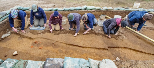
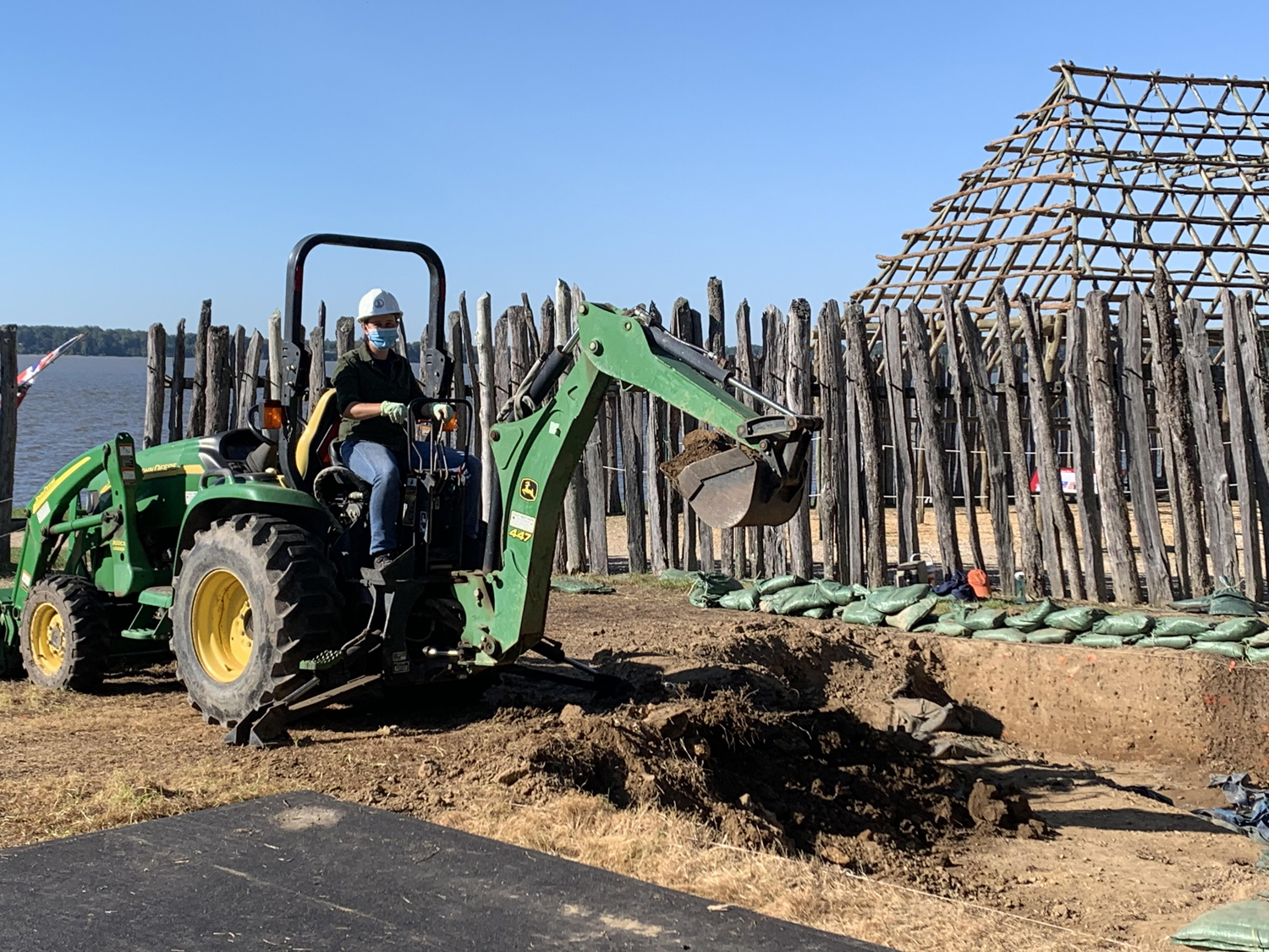
At the “Ditch 8 Site” an excavation site located just south of the churchyard, outside 1607 James Fort’s eastern palisade wall, we are working on removing modern backfill with shovels, pickaxes, and even the backhoe! This dirt was screened for artifacts during excavations in the early 2000s and then used to landscape the area, so it can be removed quickly with heavy machinery. Once this backfill is removed, the team will examine an intact strip of land running across the site. The area was left unexcavated during the previous dig because it was underneath an observation deck ramp. However, we know from the previous excavations to either side of the ramp that a large pit feature was uncovered in the area that is likely related to James Fort’s earliest years. Tests into this pit in 1999 recovered a large quantity of early 17th-century artifacts, but also left many unanswered questions. We are looking forward to returning to this site to fill the gap on our maps and to answer questions about this pit feature.
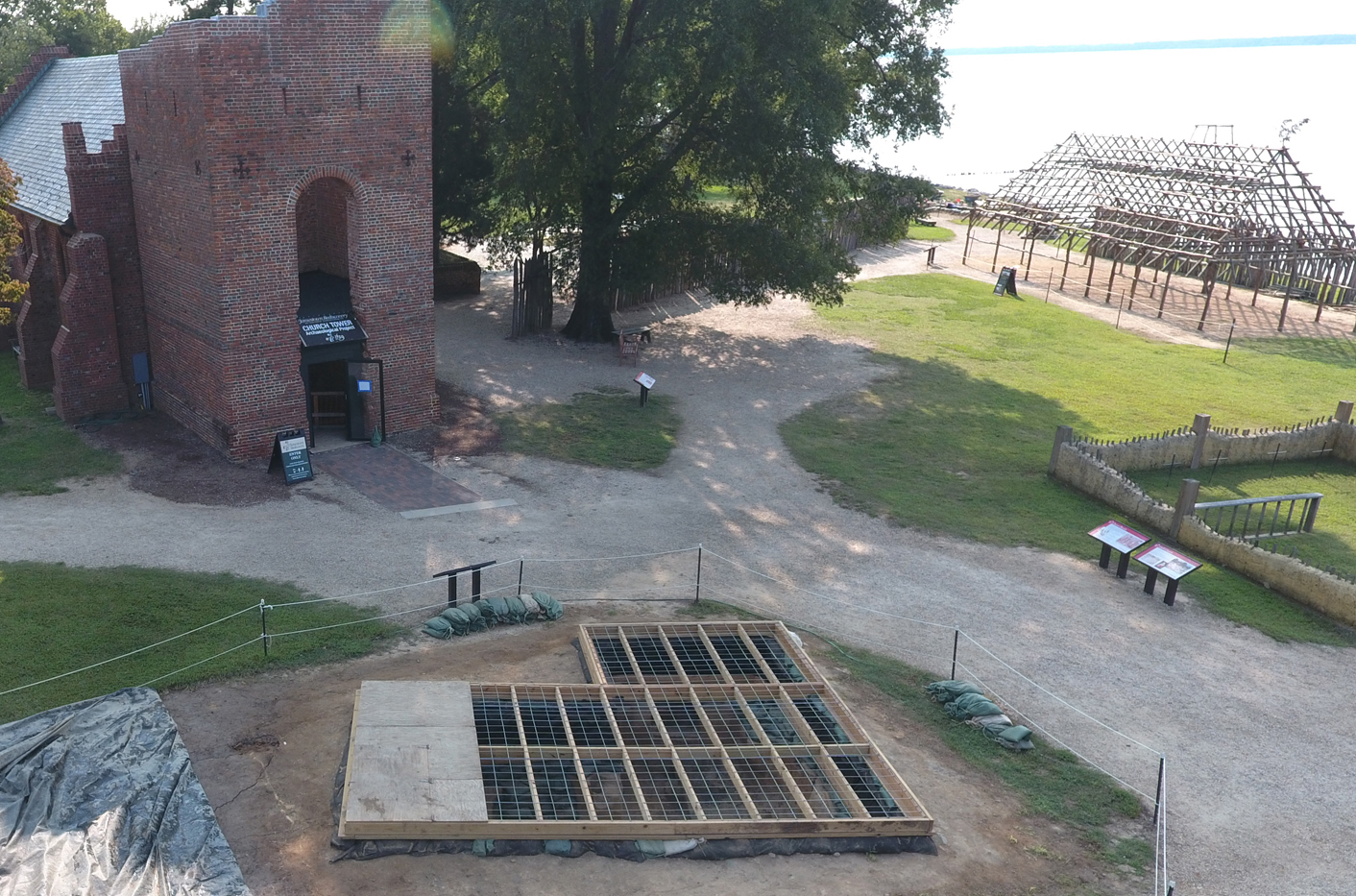
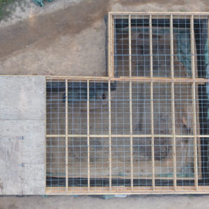
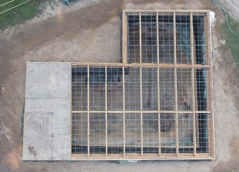
We are a team of many talents, and not all of our archaeology involves digging! One of our recent projects included reworking our method for covering the Jane Cellar, a ca. 1608 cellar used as a kitchen and located in the middle of James Fort. Since it is rather deep, it has been difficult for visitors to view the cellar and associated brick ovens. Our goal was to make the cellar safer so that we could move the ropes closer and allow people to have a better view of the historic feature below. The wire fencing across the surface ensures the safety of visitors, archaeology, and the site itself.
related images
-
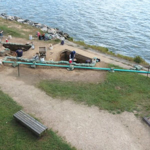
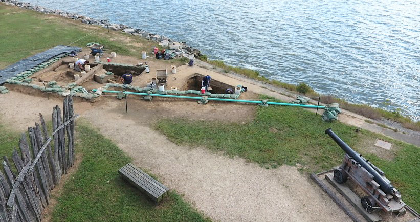
- An overhead view of our open seawall excavations near the eastern-most bulwark.
-
- The top of a case bottle, removed from the trench around a modern septic tank near the seawall.

-
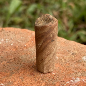
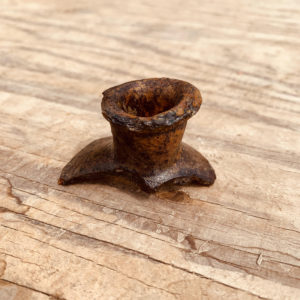
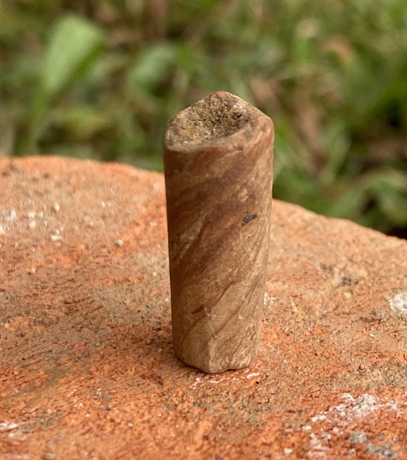
- A unique pipe stem found in the backfill around a septic tank by the seawall. This is known as a “Bookbinder’s style pipe,” which was made around the 1640s in Virginia Beach.
-
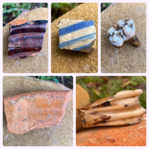
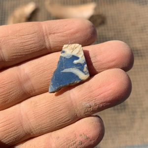
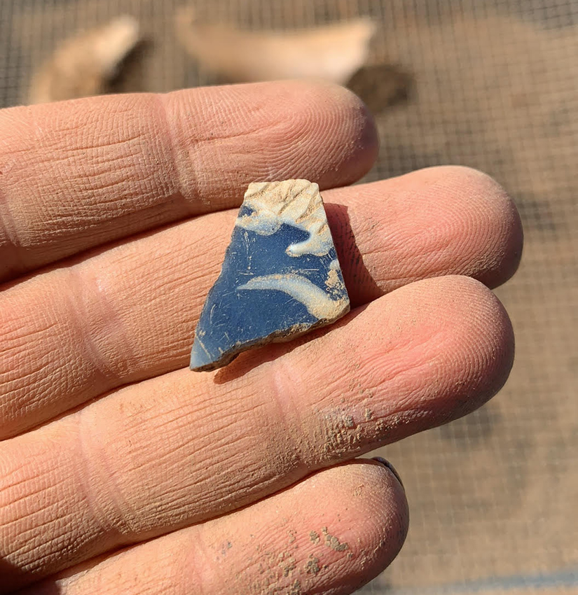
- A few of the many historic artifacts found in the builders trench for a modern utility pipe near the seawall. These include locally made pottery, European delftware, and animal teeth.

-
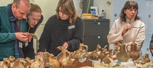
- Sometimes artifacts we find in the field can be mended together with artifacts we’ve already found. This particular piece of porcelain belongs to a vessel that Senior Curator Merry Outlaw has been piecing together over the years.
-
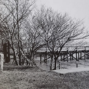
- A photo showing the location of the gatehouse (1929-1960) and docks to the east of the seawall. Our current site is adjacent to the trees, but we have plans to open up a larger area.

-
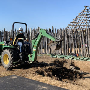
- Senior Staff Archaeologist Mary Anna Hartley operates the backhoe to remove backfill from the Ditch 8 excavation site.
-
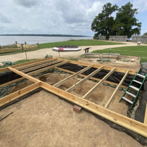
- Archaeologist Ryan Krank takes measurements to fit more joists onto the Jane cellar frame. After adding all of the joists and tie beams, the wire fencing is added on top.

-
- The completed restructuring of the cellar. The ropes were also moved in further, so now you can see down inside!
-
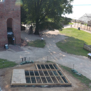
- A lovely view of the finished cellar.