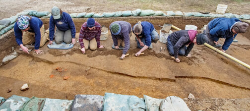
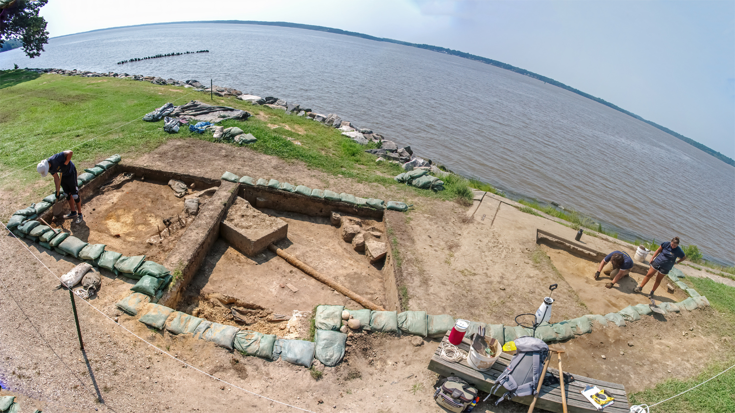
The weather, aside from a major rainstorm last week, has been very pleasant lately here at Jamestown, allowing us to consistently dig on the island. We have been focused on two of the excavation areas this month: the space behind the Nathalie P. & Alan M. Voorhees Archaearium, and the area at the southeast corner of the Seawall.
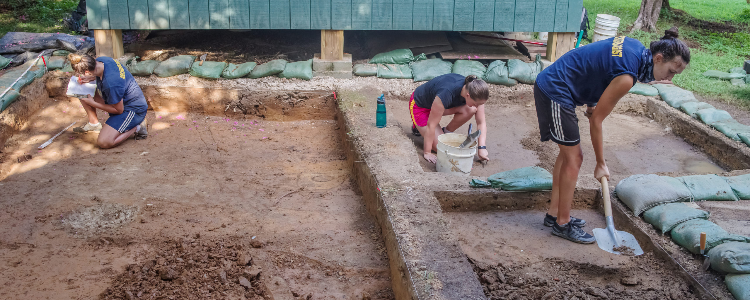
The Archaearium excavations are starting to wind down, we are confident they will be finished this month. Since our last update, we have uncovered additional features in that space. The most common features have been plowscars. We saw a few of these last month, and uncovered several more over the last few weeks. One of the things we noticed when excavating the plowscars is that they get deeper moving from south to north. Charting where plowscars and the overlying plowzone appears and disappears can provide insight into historic topography and land use. In this case, the change in depth suggests that the original ground surface in the area probably sloped downward from south to north.
Once our new plowscars were removed, we came across a set of three small, rectangular post holes. The post holes appear to have cut through the plowscars, but because the fill was so similar, they could not be distinguished until the plowscars were removed. The space where the post holes was found had a stratigraphic sequence consisting of modern topsoil (at the top), then modern fill, then plowzone (at the bottom), through which the post holes were cut. Notably, the post holes contain no redeposited modern fill or topsoil—only soil from the plowzone—indicating that they predate those soil deposits. Thus the post holes were created when the plowzone was still an open surface. The post holes seem to have been part of a historic fence line.
As often happens in archaeology, we also found the site of one of our previous excavations. A diagonal trench had been dug through the area long before the Archaearium was built. This trench cut through part of our current excavation area, and we were able to identify its boundaries. This might not sound very exciting, but the trench also contained a human burial. Once we removed the backfill from the trench and the neighboring plowzone, we were able to relocate and uncover more of the grave shaft.
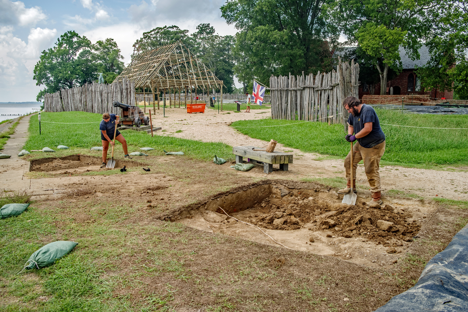
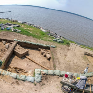
At the Seawall, we currently have three excavation units open (DD EP 21). All three contain a large number of 20th-century features, including old water and sewer pipes and buried electrical lines. The westernmost unit also contained the builder’s trench for the Sea Walk, the early 20th-century sidewalk built as a promenade along the Seawall. Underneath and next to this builder’s trench was a deposit of yellow clay that may have been put down when the Seawall was built.
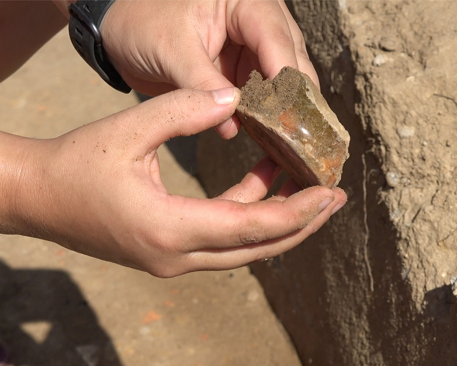
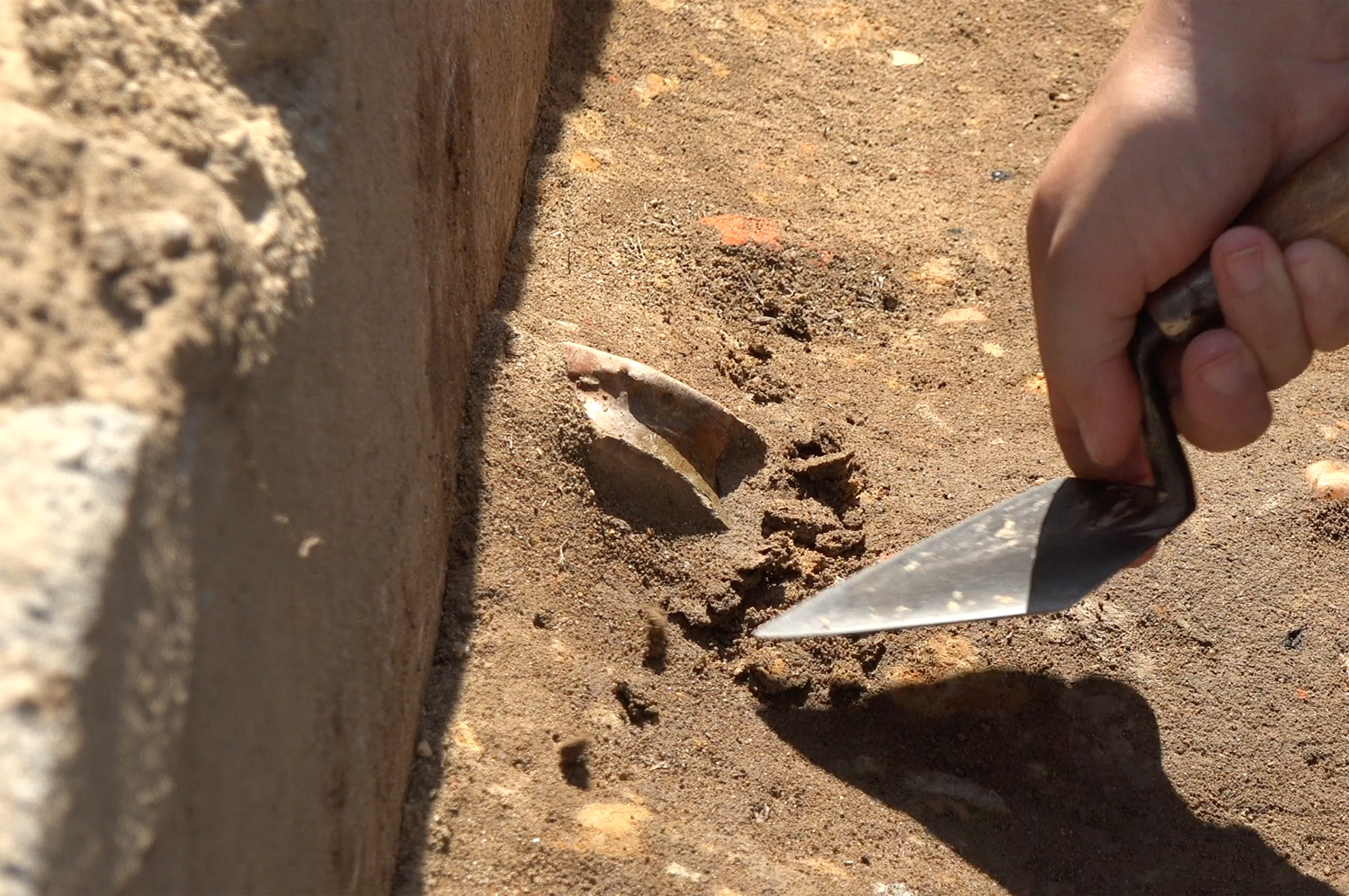
Notably, some of the 20th-century features have contained historic artifacts, including tobacco pipe fragments, and two pieces of 17-century ceramic. One of these ceramics was made by the Jamestown Potter himself, Thomas Ward, sometime in the mid-1600s (DD EP 23). The presence of these artifacts tells us that 17th-century features are probably lurking beneath the more recent disturbances. We’re excited to uncover these historic deposits; hopefully, you can be there with us to see what we find!
There is one more thing to mention this month: Blackcreek Workshop, LLC, has just finished rebuilding the 1608 Barracks building here at Jamestown. The Barracks was one of the early mud-and-stud structures in James Fort, and a reconstruction has stood on its original location since 2006. After 14 years battered by wind and rain and baked in the sun, the first reconstruction was a little worse for wear. We contracted with Blackcreek—the same team that built the 1617 Church reconstruction—to rebuild the Barracks, which should last at least another 14 years.
related images
-
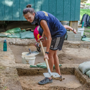
- Anna Shackelford shoveling overburden from a test unit at the Archaearium site.

-
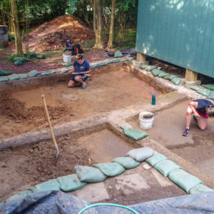
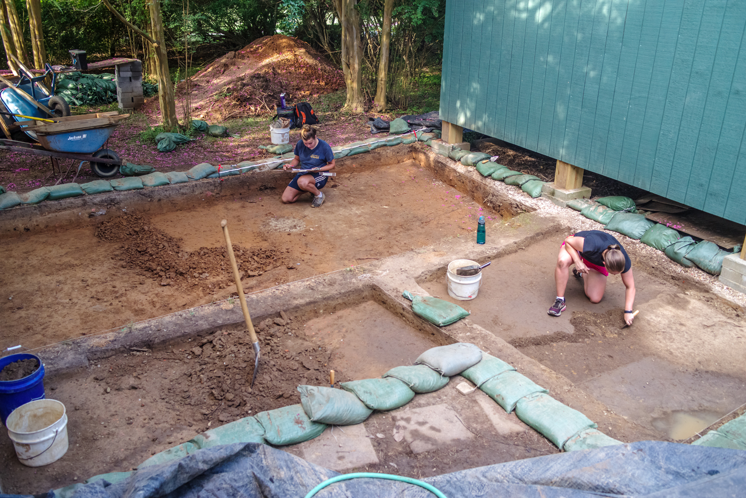
- Test Units separated by bulks at the Archaearium Site.
-
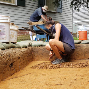
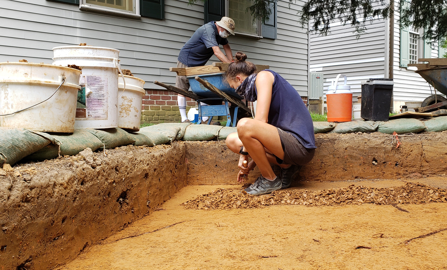
- Troweling to reveal a series of postholes at the Archaearium Site.
-
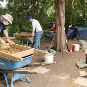
- Screening the overburden from the test units.

-
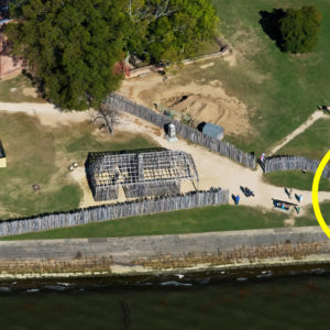
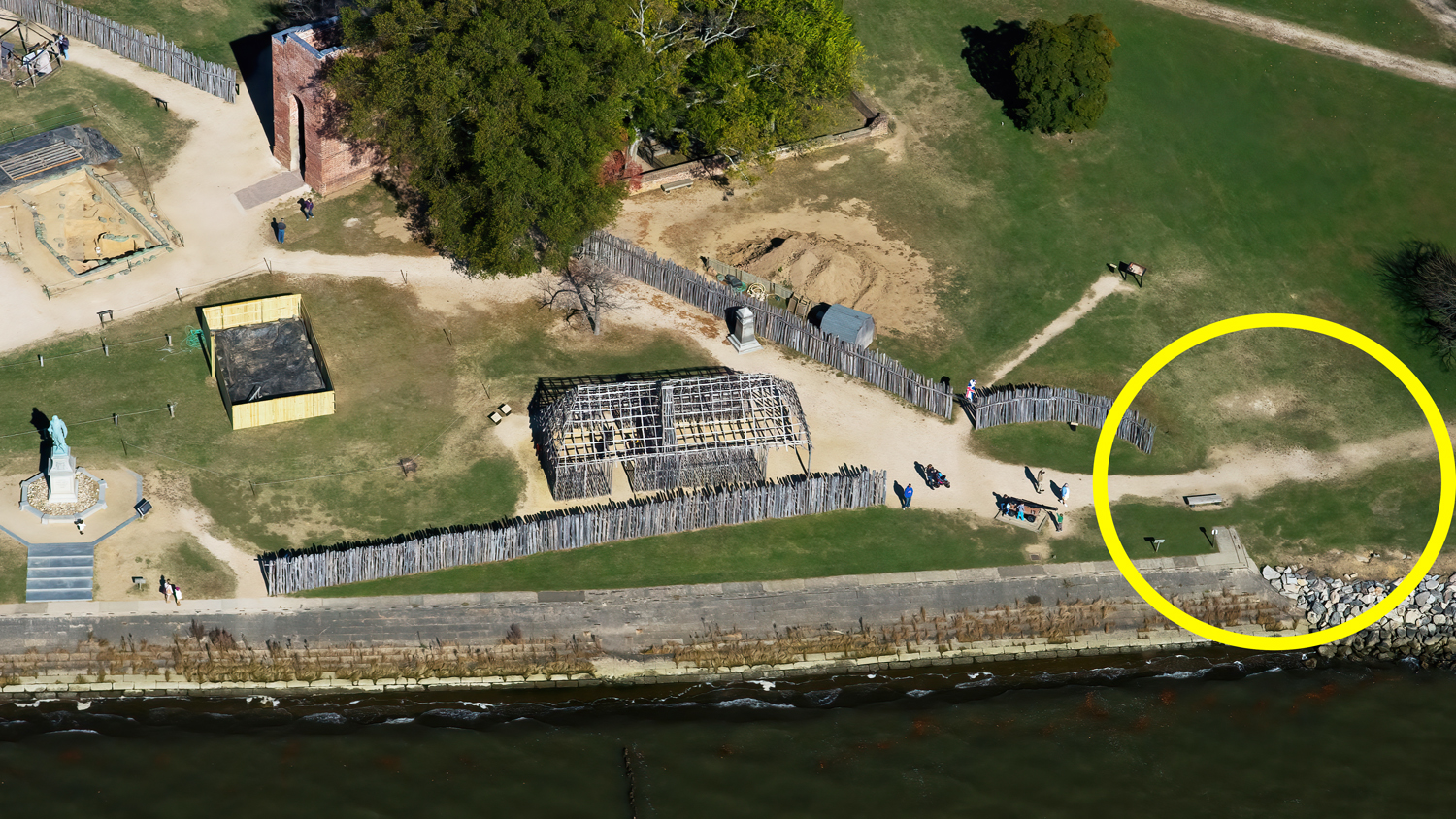
- Aerial photo of the southeast corner of 1607 James Fort. Circled is the site of the present excavations.
-
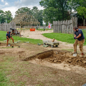
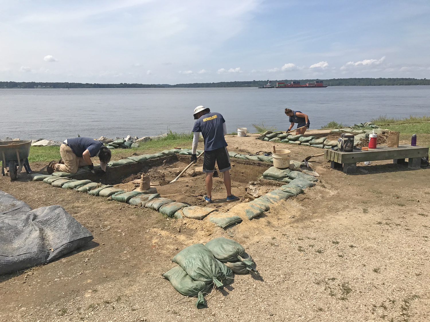
- Opening test units at the Sea Wall Site.
-
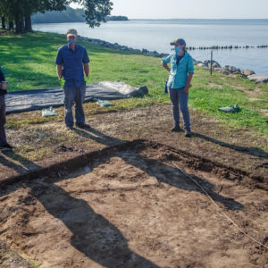
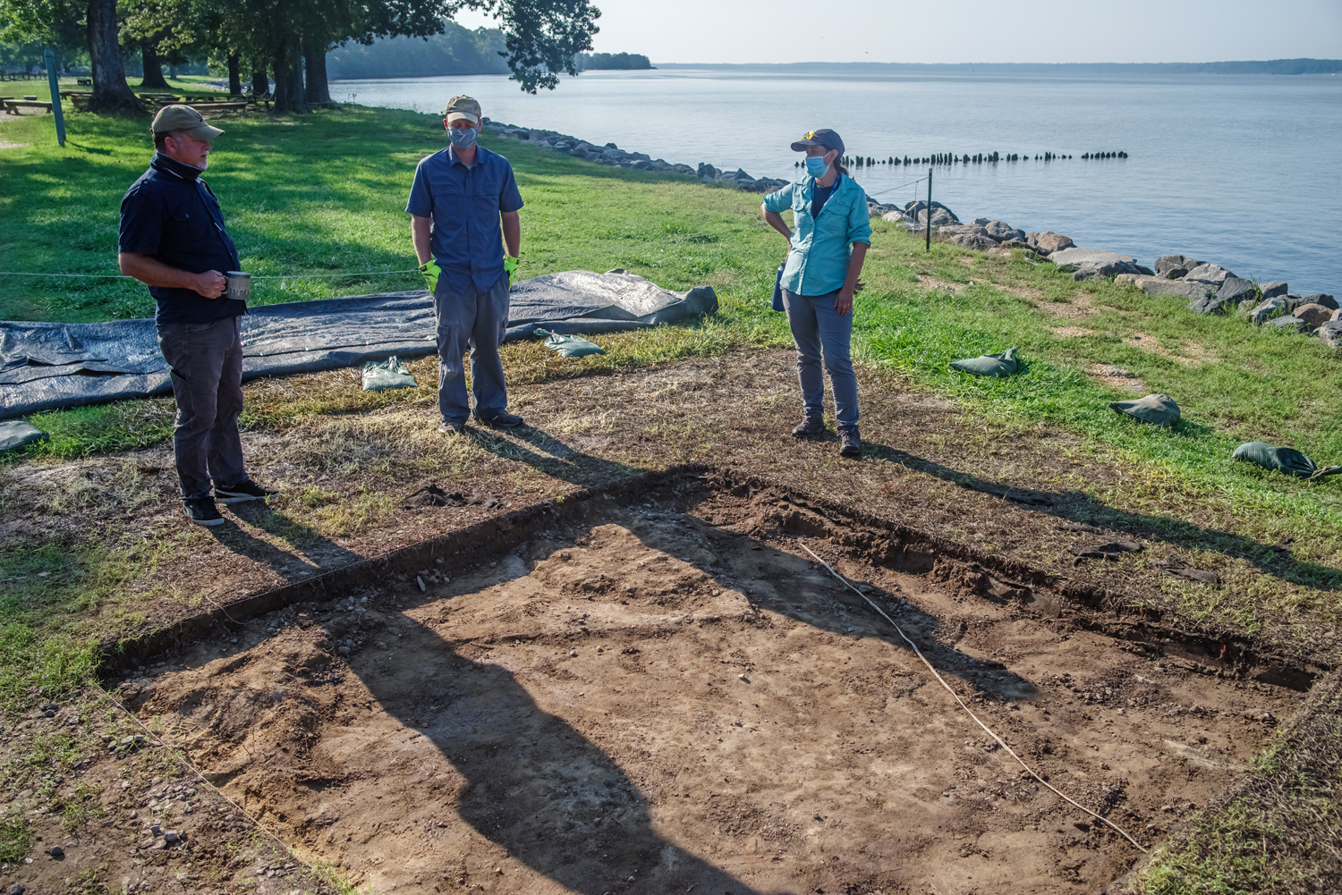
- Director Dave Givens talks with Senior Staff Sean Romo and Mary Anna Hartley at one of the new units at the Sea Wall site.
-
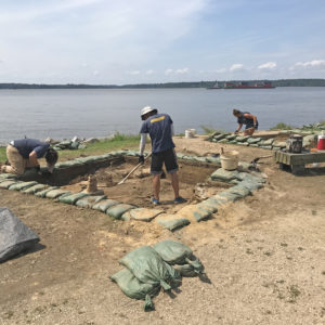
- The team digs units along the seawall.
-
- Modern Utility lines crossing through the upper layers of the new units at the Sea Wall Site.
-
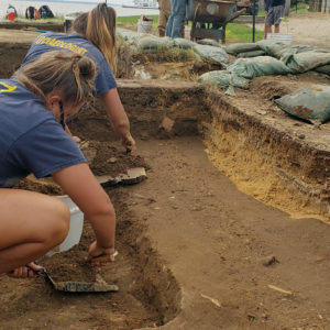
- Kendall Gamble and Nicole Roenicke trowel clean one of the units at the Sea Wall Site. The orange sand to the right is backfill from where the previous archaeology stopped in 2002.

-
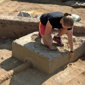
- Caitlin Delmas kneels on an abandoned septic tank and points to a historic ceramic
-
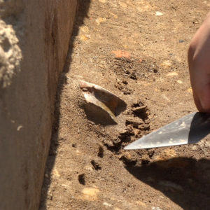
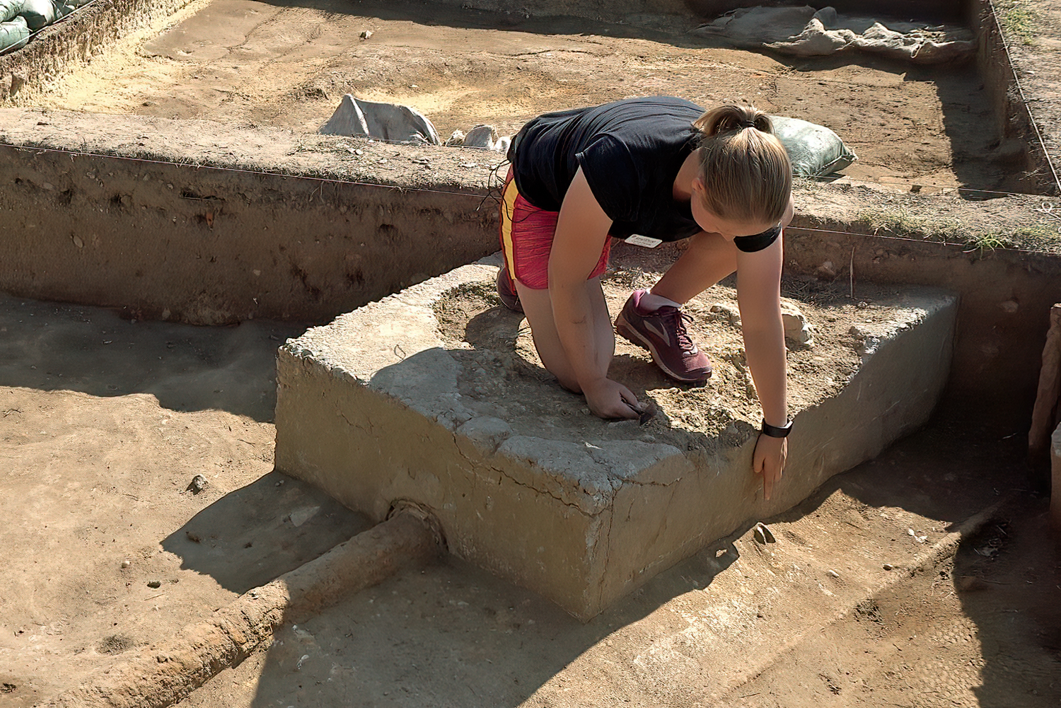
- Historic ceramic in the builder’s trench for the old sewer tank.. The ceramic was disturbed by this modern utility from an early 17th-century context.
-
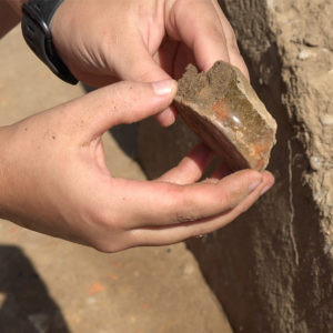
- The ceramic was identified as the base to a drinking cup made by Thomas Ward. For more about this artifact check our Jamestown Rediscovery YouTube for “Dig Deeper: Episode 23.”