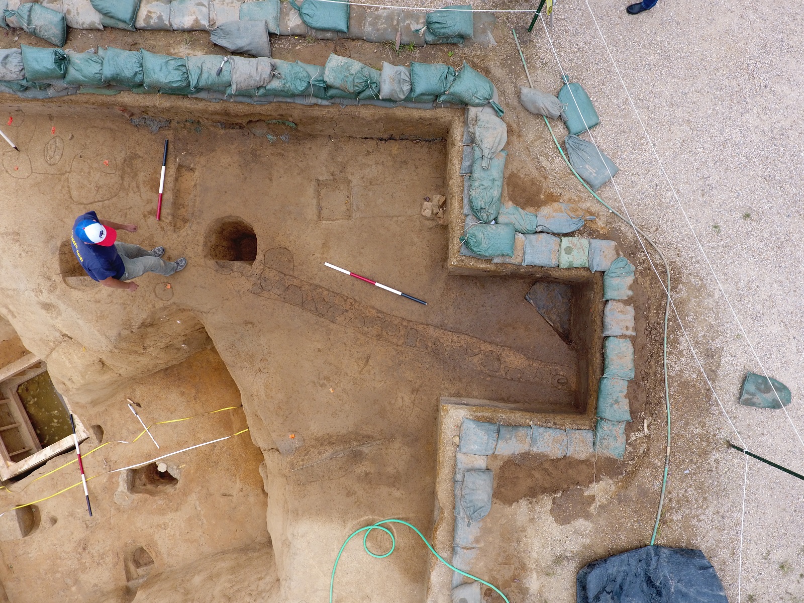
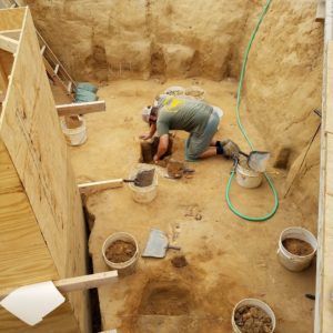
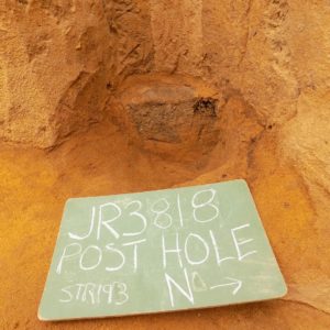
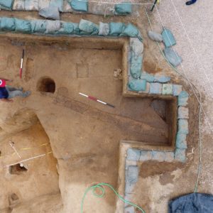
Following the completion of the well excavation in September, the Jamestown Rediscovery team concentrated on finishing their excavations of Structure 193’s cellar, located at 1608 James Fort’s northeast cover. They tested a majority of the postholes along the cellar walls and dug three features cutting through the center of its subsoil floor. Also, the large posthole located at the northeast corner of the 1608 fort extension was excavated, and the extension palisade trench was thoroughly troweled in order to define individual post molds where each upright timber once stood.
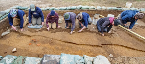
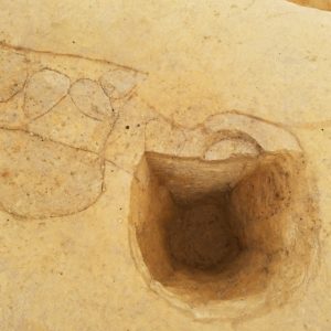
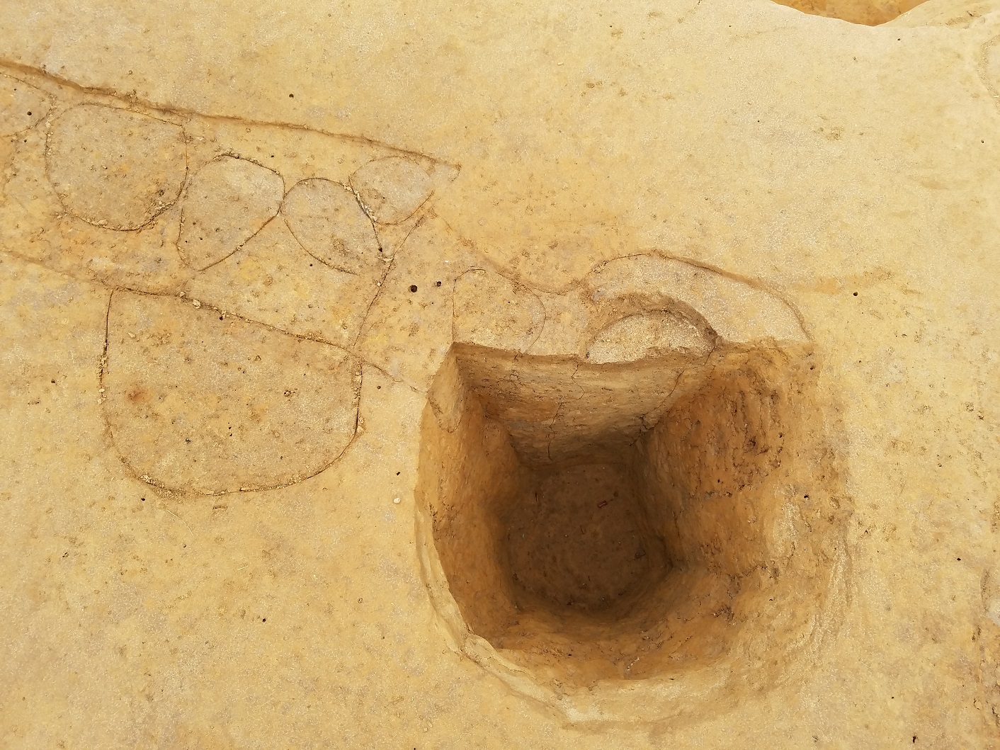
The last features to excavate in the cellar were the posts carved along the interior of the walls. Tests revealed that all of the posts were quite small and shallow, measuring between ½ inch and 3 inches in depth. In contrast to the cellar in James Fort that was once used as a blacksmith shop (Structure 183), which had one foot wide postholes dug deep into that cellar floor, these posts were still sitting directly on the subsoil shelf at the floor level when the cellar was filled in around them. Therefore, the only evidence left by the wooden posts was stains on the cellar filled in around them. The team theorizes that these posts along the cellar’s interior walls did not anchor the structure above the cellar, but may have supported joists for a floor above.
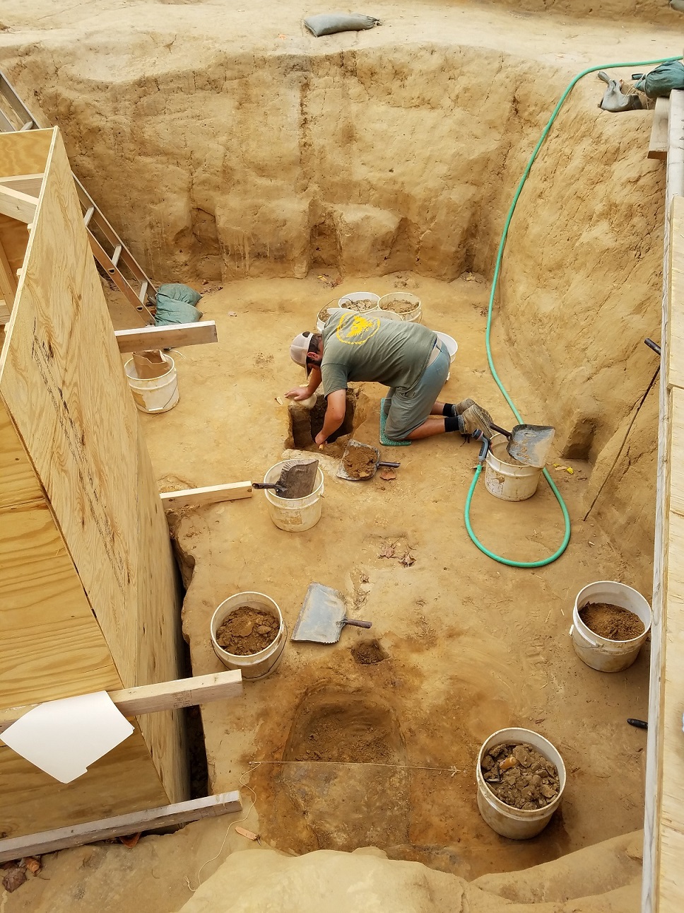
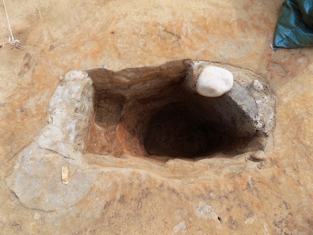
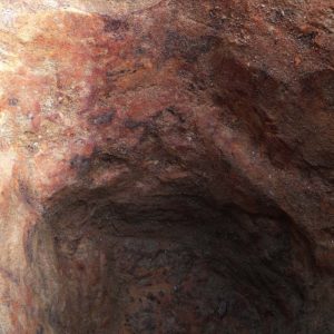
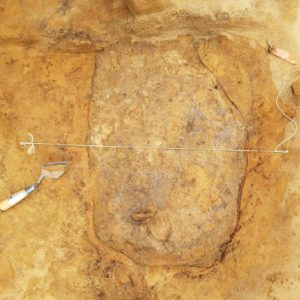
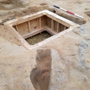
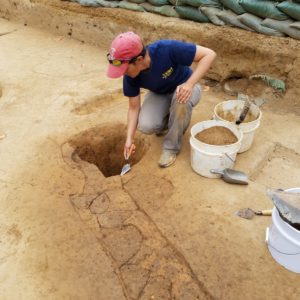
Three features more centrally located in the cellar’s west and east chambers were also excavated. Initially, all three appeared to be sumps for managing water leaking in and eroding the cellar floor during rain events. The most interesting of the three features was the one in the cellar’s west chamber. Cut by two later features, this rectangular pit was filled with a very compact gray clay that is occurs naturally at around 14 or 15 feet deep. Evidently, the colonists had a source for this clay from somewhere nearby and used it to backfill this pit during one phase of cellar repairs. The removal of this clay fill during excavation revealed stains of iron and manganese concentrated on the pit’s interior sand walls. This pit was likely a posthole for a post which was replaced at least once, evident by a second posthole sealing it.
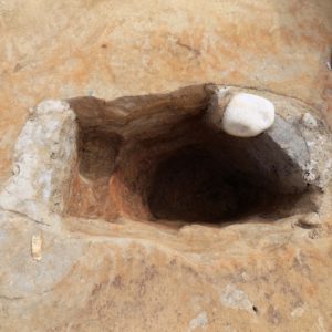
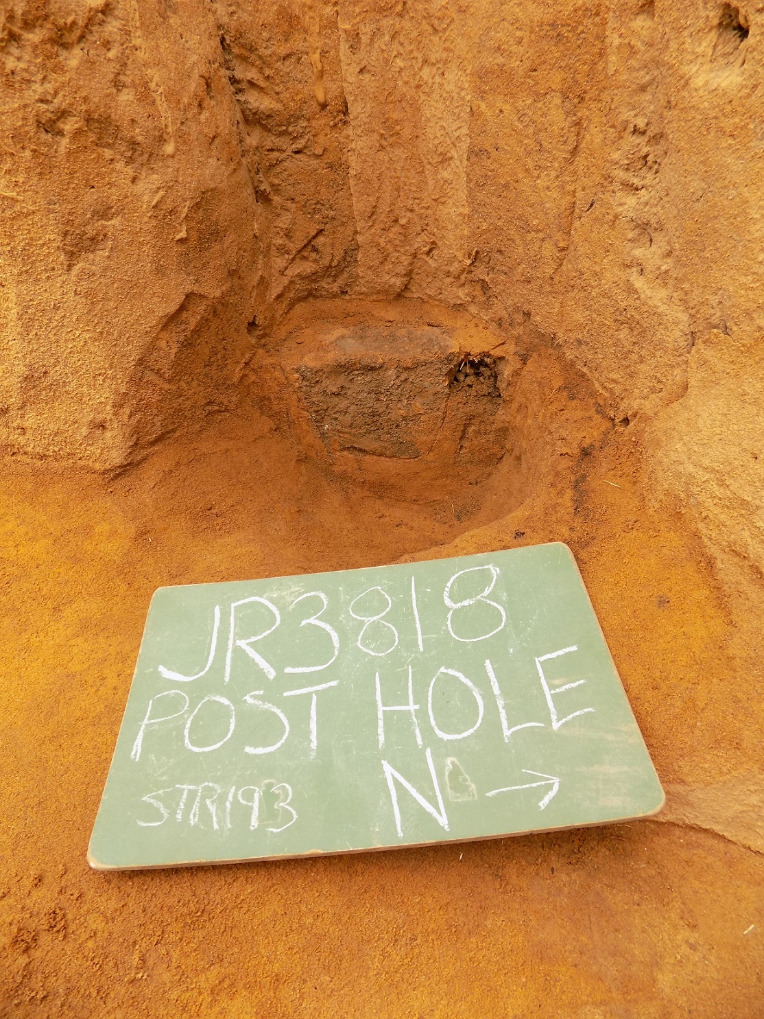
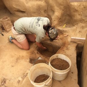
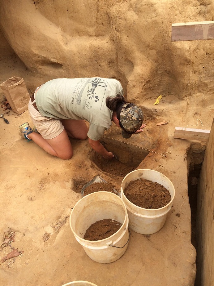
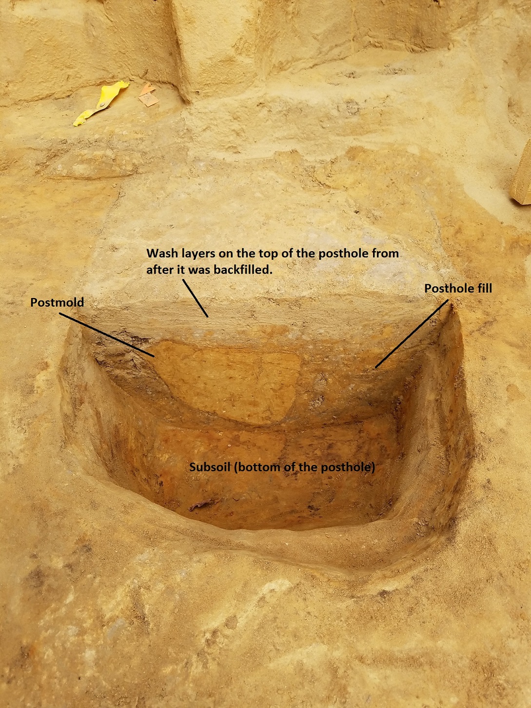
The second pit was located just north of the well shaft and excavations revealed that it was posthole about one foot deep. It was likely a support post for a structure above the cellar. While not originally intended for use as a sump, the top three inches of fill in the posthole showed evidence of water washing into it. So, it worked as a sump after the posthole was backfilled. Located east of the well, the third pit tested remains a bit of a mystery. There was no sign of a post mold during excavation, leaving the team to puzzle about its use.
In reviewing all the evidence, Kelso and the team are confident that this building served a military purpose due to its strategic location at the fort’s northeast corner and the overall lack of domestic features and artifacts discovered in and around it. Perhaps this is the blockhouse mentioned by Lord De La Warr, Sir Thomas Gates, and others in July 1610, shortly following his arrival at Jamestown. In their “Letter to the Virginia Company of London” they paint a picture of a fort in ruins, with a dwindling population who are struggling to survive famine and attacks by the Virginia Indians. After that description, they state that, “only the blockhouse, somewhat regarded, was the safety of the remainder that lived…” Could Structure 193 be this blockhouse? By blockhouse, the colonists may have been referring to the blockhouse guarding the nearby isthmus, but the archaeology does show that Structure 193 was looked after for quite some time before it was dismantled. Clearly the building was strategically important to the settlers because the cellar is not backfilled until around 1620.
On the ground surface above the cellar, the archaeologists tested a posthole that they believed might relate to building above the cellar. This post, located at the corner where the 1608 addition’s north palisade and east palisades join, was over three feet deep! This evidence suggested that it definitely could relate to the structure over the cellar. However, Director of Archaeology Dr. Bill Kelso shared an alternative theory. He suggests that this post may have been where a flag pole stood at this north east corner. A similar posthole was found at corner of the north bulwark and west palisade wall in 2005 and is interpreted as the flag pole.
Another theory Kelso proposed that this post was part of a watch tower, which was contemporary to Structure 193. In “A True Reportory,” colony secretary Will Strachey described where the fort’s lines meet as having either a bulwark or watchtower raised. Since there is no bulwark at this northeast corner, it seems reasonable to assume that it may have had a tower.
Check out the photos below for pictures of the palisade posts defined and check out the Dig Update video about how we are using drone technology to map our site!
related images
-
- Bob Chartrand works on a deep posthole down in the middle of the west chamber of the cellar.
-
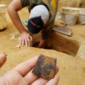
- Chartrand discovered a large fragment of a turtle shell in the possible posthole. Likely, discarded food remains.

-
- Posthole in the center of the west chamber of the cellar. Post may have been used to support the structure that stood over the cellar.
-
- Iron and manganese staining in the interior of the support posthole believed to be related to an oscillating water table saturating the soil and leaching elements from the clay filling it into the surrounding subsoil.

-
- An example of one of the small shallow postholes along the subsoil walls of the cellar. These posts may have supported the joist beams for the floor, but were not anchored deep enough to indicate that they supported the building.
-
- A feature north of the well shaft in the cellar prior to excavation.

-
- Mary Anna R. Hartley excavating the feature north of the well shaft.
-
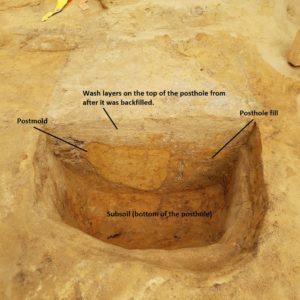
- The feature north of the well shaft was identified as posthole used to support a portion of the floor or structure above the cellar, but was backfilled during alterations made to the building and ended up acting as a sump in the cellar floor.
-
- The pit to the east of the well. Might have been intended as a sump.

-
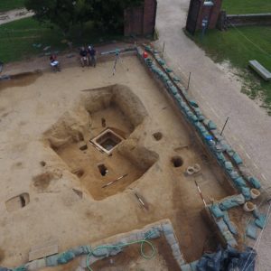
- Drone shot of the cellar after the postholes were tested.

-
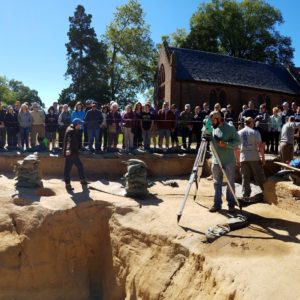
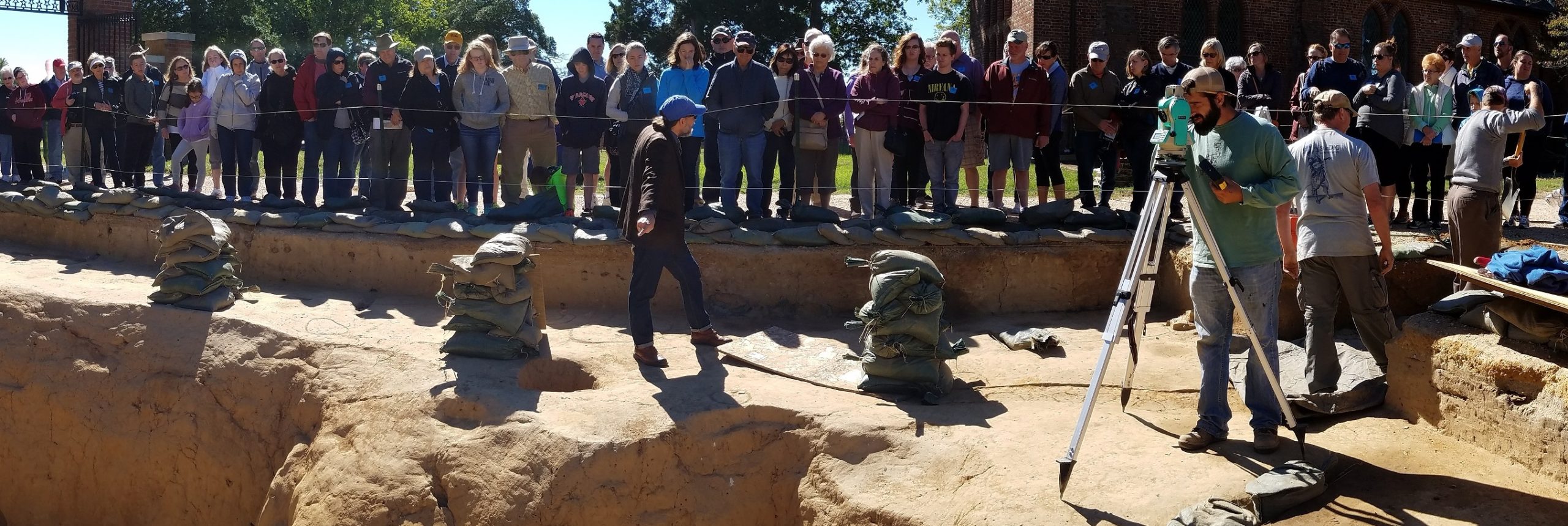
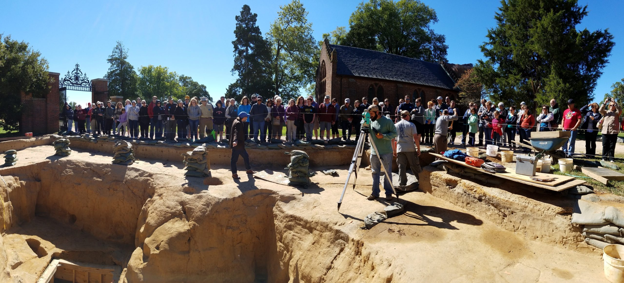
- Bob Chartrand uses the total station to gather points to use in 3-D mapping the cellar. Willie Balderson leads an archaeology tour behind him.
-
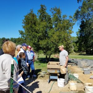
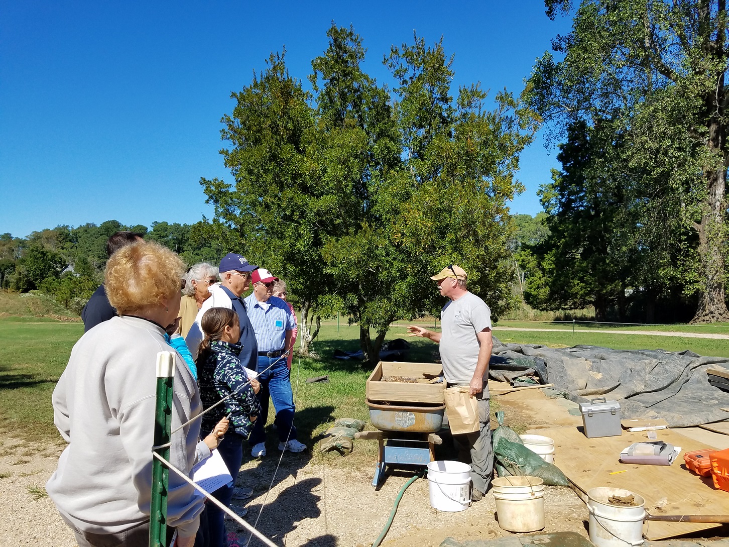
- Volunteer Chuck Durfor interprets the site to visitors
-
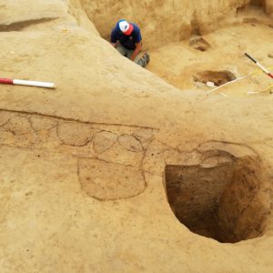
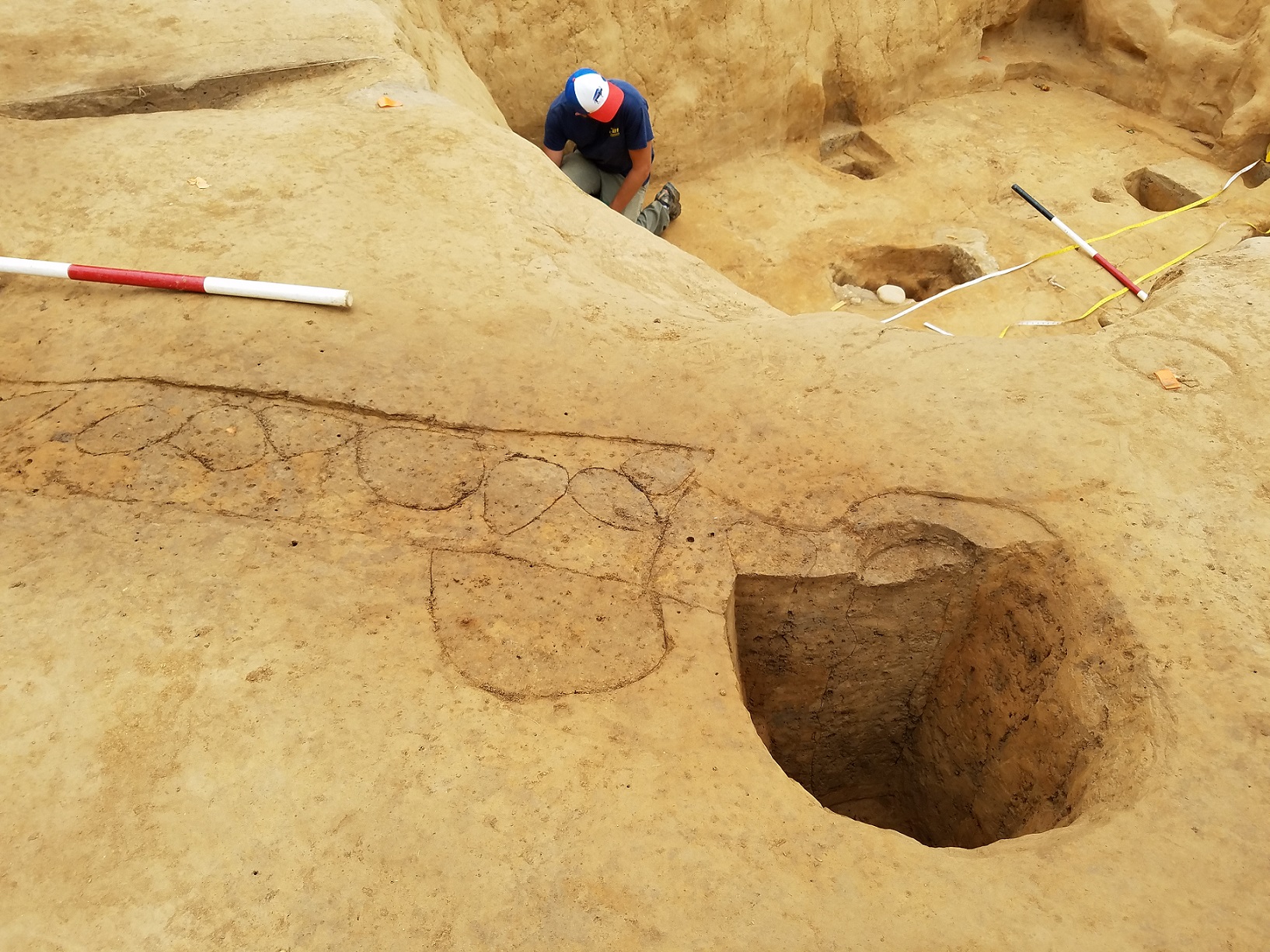
- A large posthole at the northeast corner of James Fort circa 1608, which may be part of a watchtower or a flag pole. Danny Schmidt is visible in the cellar below.
-
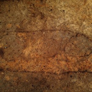
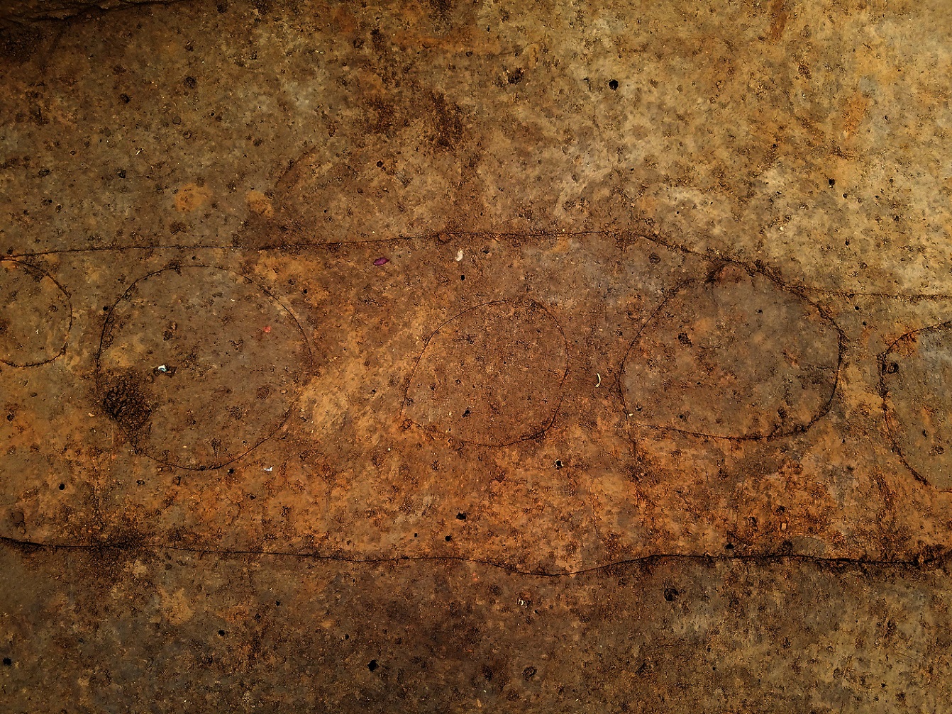
- Working to define some of the soil stains showing where upright timbers once stood in the palisade trench.
-
- Mary Anna R. Hartley points to a small section of palisade which was added from the main line to connect the post at the corner. The post might relate to a watchtower or flagpole.

-
- The 3ft deep post, which might relate to a watchtower or flagpole.
-
- Drone shot of the palisade section heading east toward 1607 James Fort.