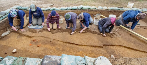
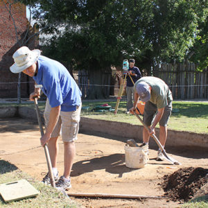
Work has shifted to an area along the east palisade wall just south of the church tower. Three 10’x10′ squares are currently being excavated here inside which seven burials have been found. Two of the burials are probably children’s due to their size. Before the Jamestown Rediscovery team focused on this area, work had progressed on an area near the north bulwark of James Fort. In this area archaeologists believe they have found a spot where the early colonists were producing iron. Just feet away, an ivory compass was found in an early posthole.
Past excavations in adjacent squares have turned up three post-fort-period 17th-century ditches and the new excavations have revealed the continuation of these ditches. Thought to date to well after the fort period, the ditches may have been property boundary ditches or ditches used to keep livestock contained. One of the ditches has a zigzag shape, suggesting that it mirrored a Virginia Rail-type fence.
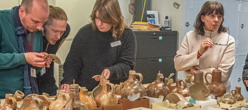
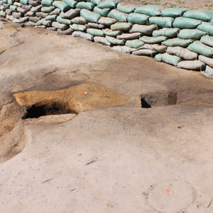
Seven burials have been found here, two of which are probably children’s graves due to their size. On the south end of the excavation area a section of a 1930s utility trench has been found. During the construction of the trench close to eighty years ago, the workers found several artifacts. When William Kelso, head of the Jamestown Rediscovery Project, was first beginning his search for James Fort in the 1990s, he and curator Bly Straube examined the finds of the trench diggers and determined that the artifacts they found could be early enough to date to the fort period. Because of this, Dr. Kelso chose to dig close to the 1930s trench and started to find fort-period artifacts within the first couple of shovelfuls.
In the northernmost of the three squares a near-perfect circle of discolored soil was found with decayed roots throughout. The hole is fairly modern and it is thought that the tree that once stood there was the product of a landscaping effort within the past hundred years. The entire area encompassing the three squares and the surrounding ground had its top layers removed in 1861 to get the soil needed to make the Confederate earthen fort that once covered much of James Fort’s footprint.
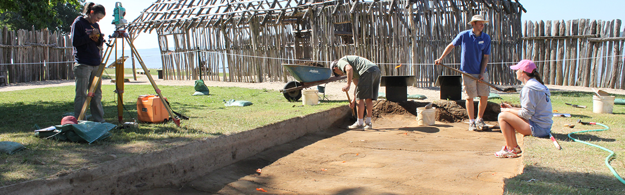
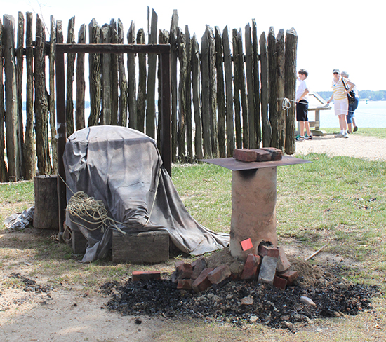
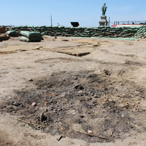
Excavations continue in an area in the middle of the fort near the northern bulwark that was the subject of last month’s update. Much of the iron slag pit has been excavated and one section remains which is deeper than the rest. It is thought that this was where an iron bloomery stood. This area will be excavated as part of the 400th anniversary of the arrival of Lord De La Warr on June 12. Also on that day, just outside the fort, blacksmiths from Colonial Williamsburg will be producing iron at a bloomery using the same techniques that the colonists at Jamestown used.
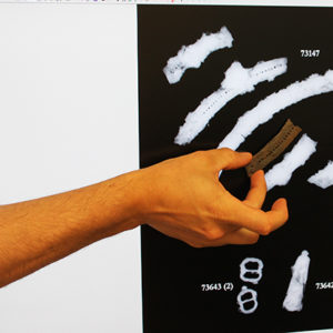
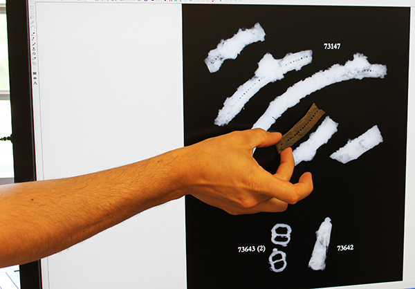
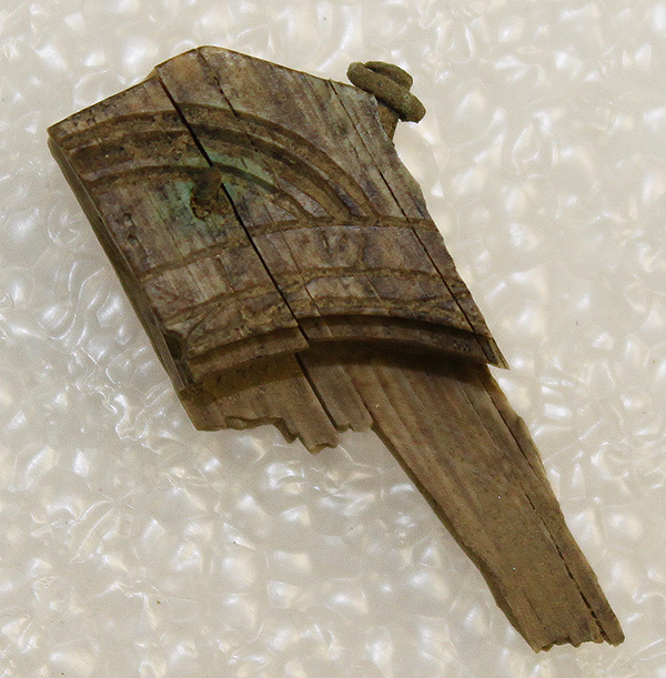
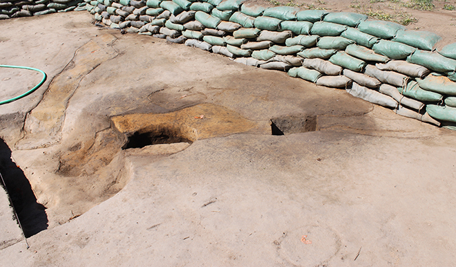
To the south of the bloomery are two very early trenches that meet together at a right angle. These possibly were part of the foundation of a building, but we may never know for sure. These two sections of trench are likely all that remain of the building as the rest of the archaeological footprint was destroyed when a mid-to-late 17th-century building was built where it once stood. This later building is thought to have burned during Bacon’s Rebellion. One of the two trenches is cut by a newer posthole. Excavation of the trench section cut by the posthole led to the discovery of a fragment of an ivory compass. The Roman numerals “V” and “VI” can be seen etched into the compass.
related images
-
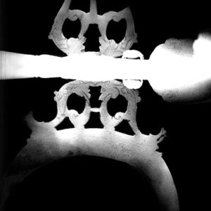
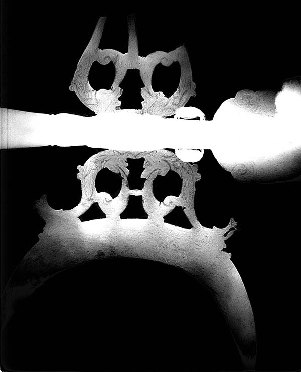
- An enhanced x-ray of the halberd shows the detail on the blade
-
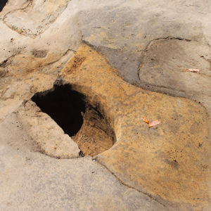
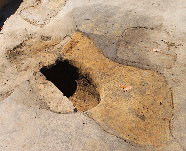
- Excavation of the posthole that contained the ivory compass fragment
-
- Excavations in the southernmost square

-
- Part of an iron circle that was used to hold the boards of a buckler together. Its x-ray can be seen just below the artifact.
-
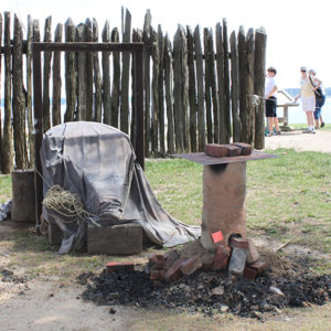
- The iron bloomery built by the Colonial Williamsburg blacksmiths.
-
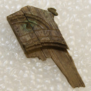
- The ivory compass fragment
-
- The outlines of the conjoining trenches
-
- The slag pit (possible site of an iron bloomery)