On the 29th of last month, Historic Jamestowne opened to the public for the first time since the COVID-19 pandemic began. We were thrilled to see visitors on the island once again; thank you to all who have been coming out to the site! While we’ve been hard at work excavating since early June, our jobs are much more meaningful when we have a chance to talk with visitors about what we have been finding.
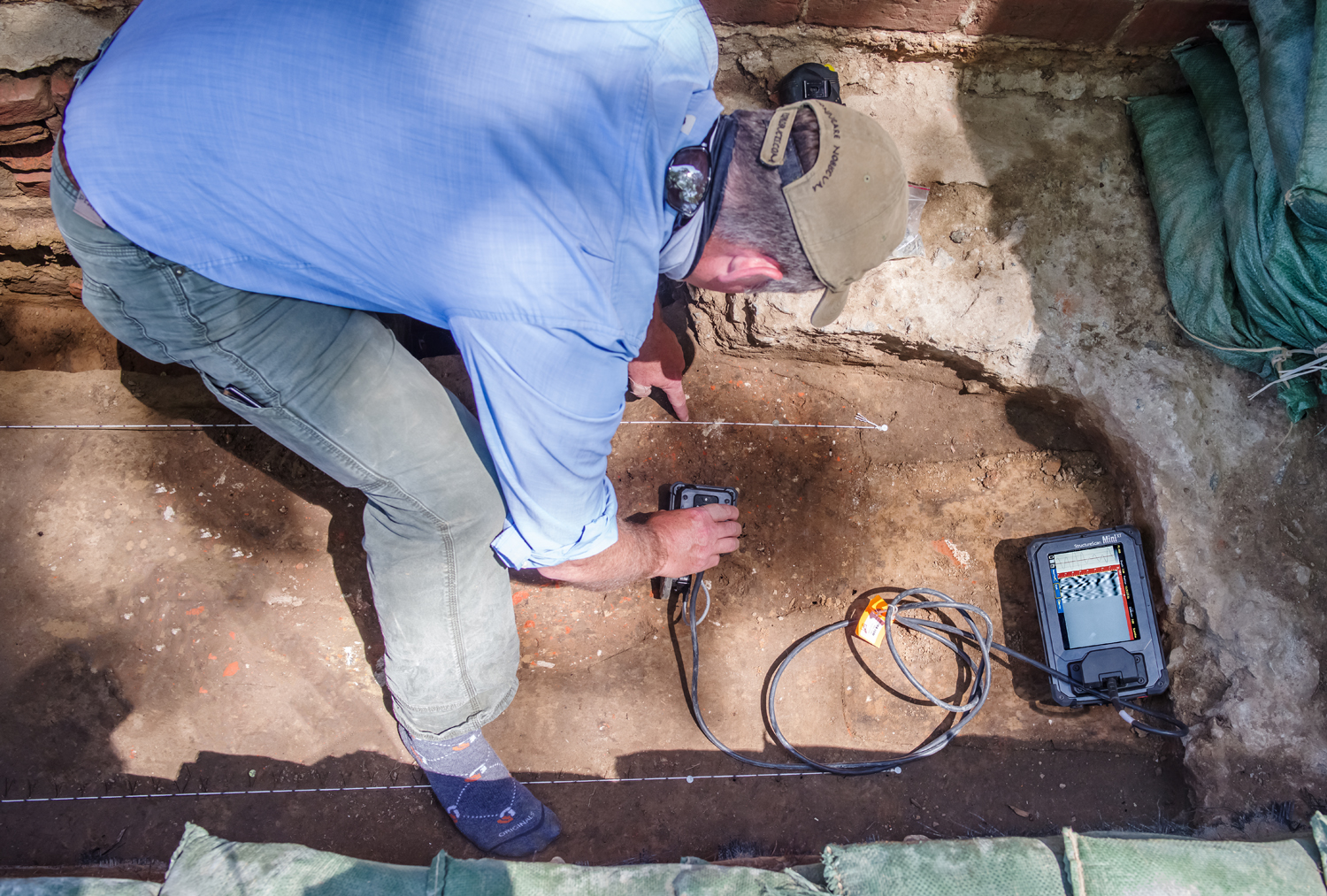
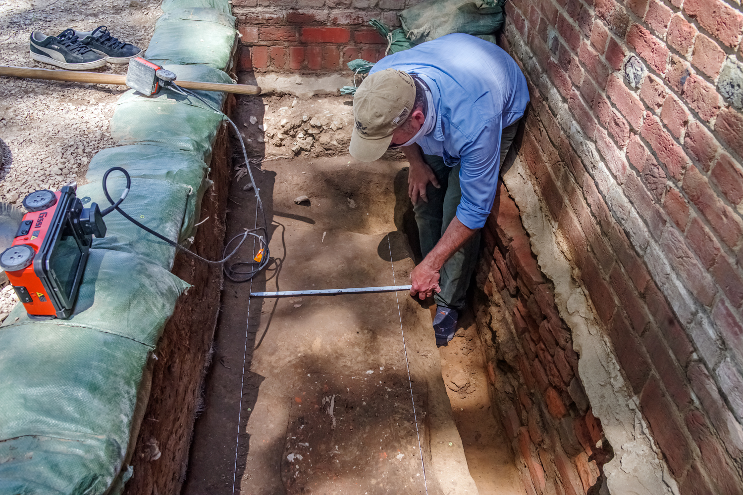
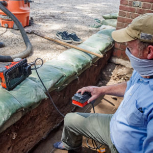
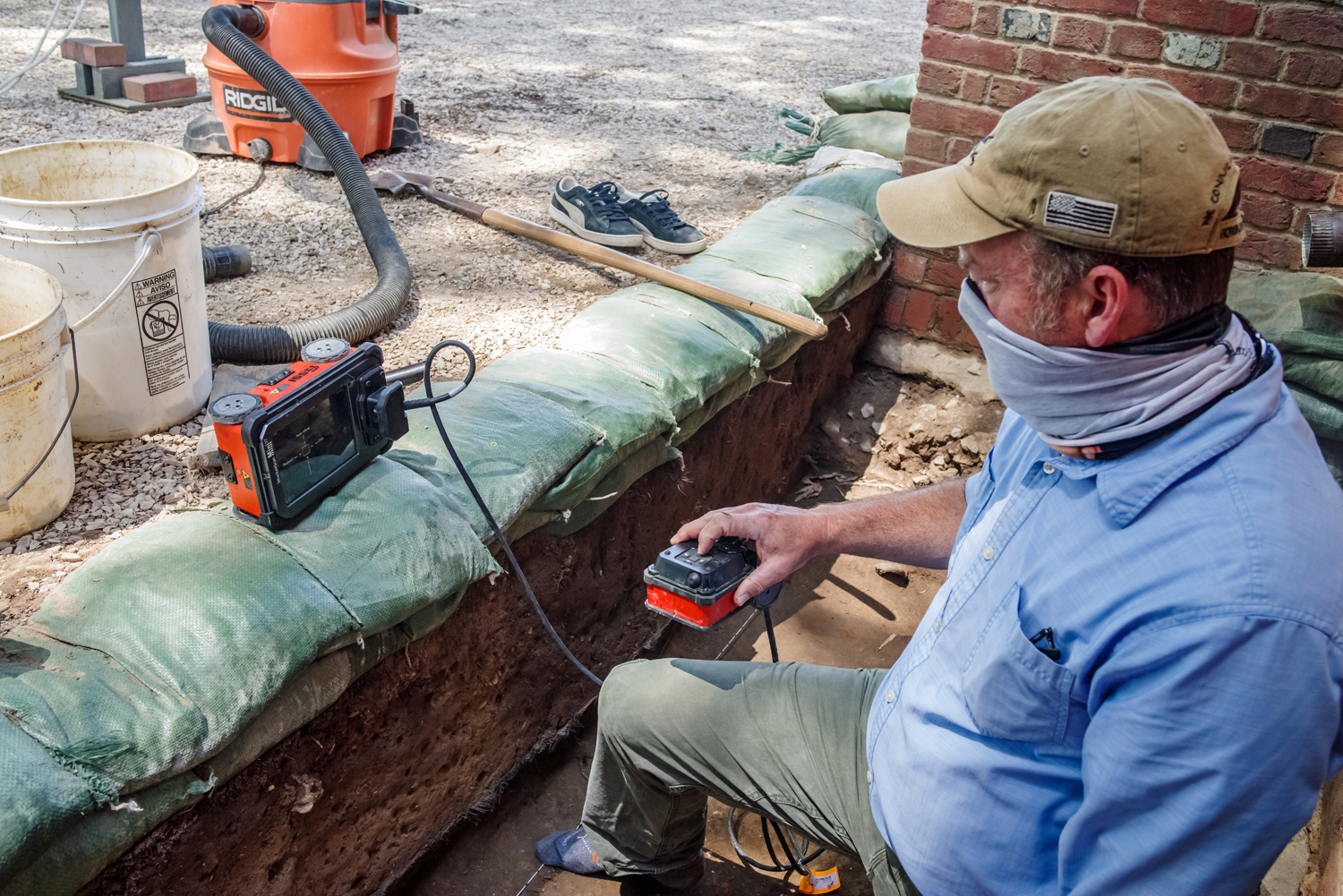
Since getting back into the field, we have been focusing on excavating in two new areas, and finishing up some old digs. The older digs are located on the south side of the Memorial Church. Last year, we uncovered a portion of the foundation for the 1639 Brick Church—the building that the Memorial Church reconstructs. The excavations to uncover the foundation took place near the west end of the building. When we dug there, we did not just find the 1639 foundation: we also uncovered portions of two burials. One of these was relatively small, no more than a few feet in length. The small size tells us that it was a burial for a child. Recently, we decided to examine the burial using ground-penetrating radar (GPR). We have used GPR in the past to look at burials, including inside the Memorial Church, where we were able to get an image of a skeleton in the ground before we excavated it. Our GPR scan of the child burial outside the Brick Church did not show a full skeleton, but we did see some bones, suggesting the skeleton is partially intact.
Right now, we are not planning on excavating the child burial. In fact, our excavations at the southwest corner of the Memorial Church are nearly complete. We are going to be closing up the excavation area soon, putting soil over our finds to keep them preserved. We are doing the same in the space we dug east of the Memorial Church and churchyard last year. In that area, we uncovered several burials and the original foundations for the churchyard wall. We covered the finds with geotextile fabric and are putting soil down on top, to make sure they survive for future generations.
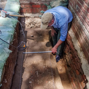
We are also still working at the original entrance to the 1639 Brick Church. At the moment, we are closely studying the brick pad that marks the entryway, in order to determine when it was first built, and when subsequent modifications took place. Multiple types of mortar were used in the construction of the brick pad; these different types of mortar indicate different construction/modification events. The most recent mortar is grey in color, and sat atop part of a historic burial. The mortar also capped a deposit of yellow clay—possibly used as leveling for the space—and a debris-filled soil that may have built up while the 1617 Church was in use.
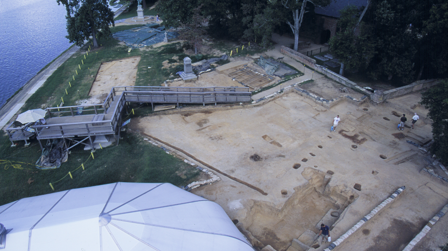
One of our new excavation areas is located south of the churchyard. Excavations by Jamestown Rediscovery in this area first began in the mid-1990s, and uncovered soil stains for palisade walls and a bulwark trench—the first evidence of 1607 James Fort! By September 1996, the team was confident enough in the discovery to announce it to the world. Because many people wished to visit the dig site to see the remnants of the fort for themselves, Rediscovery hired a contractor to construct a large, wooden observation deck over the site from which people could observe the excavations as they progressed. The site deck was built approximately 10 feet high and stood on piers anchored in concrete footings. From this elevated vantage point, visitors had a good view of the archaeologists at work and could witness the moments of discovery. The deck also included a 10-foot-wide ramp that extended down towards the churchyard wall and allowed anyone to easily access the view.
The team continued excavations around the deck until about 2000, during which they uncovered part of the 1608 extension to James Fort, a large cellar for a factory structure, John White’s warehouse dated to the 1640s, many burials, and multiple boundary ditches. Most of the area was investigated except for the test units directly beneath the ramp. As Jamestown Rediscovery planned excavations for this season, the team decided to return to these unfinished units just outside the east wall. According to the map and past field notes, archaeologists should find a convergence of some of those previously discovered ditches. The team also recorded finding part of a large pit feature in the area—cut by at least two ditches—which was tested in 1998 and reportedly contained early 17th-century artifacts that might relate to the first three years of the fort. After completing those excavations in the early 2000s, this area was backfilled and heavily landscaped.
The team is currently removing this backfill, in order to re-expose some of the burials, ditches, and pits found in the 1990s. Once this is done, we will be digging into the previously untouched space that had been under the ramp. We are excited to add to our understanding of the features in the area, especially the ditches, since these types of features can help us chart out how and when property boundaries changed.
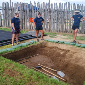
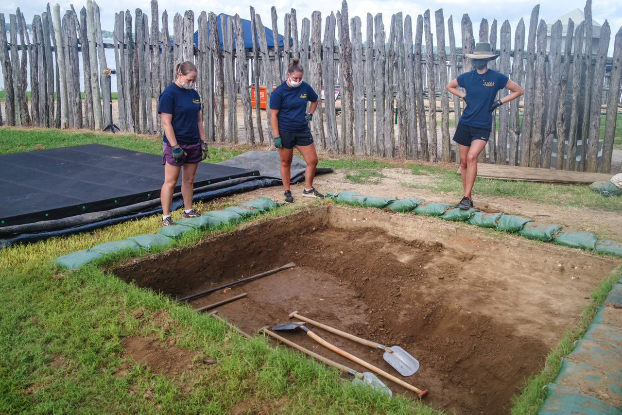
Our other new area is behind the Yeardley Building and the Archaearium. We ran GPR in that space and identified some interesting features, including a possible fortification ditch. We have three 10-foot excavation units open in that space, and have recently reached the level at which early archaeological features should appear. With any luck, we will be able to see the possible fortification ditch soon. Stay tuned.
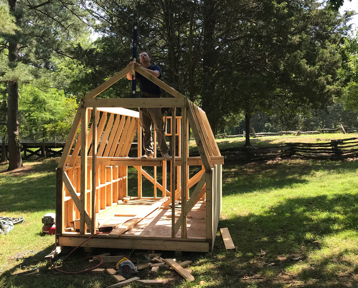
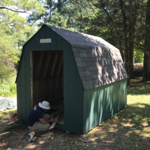
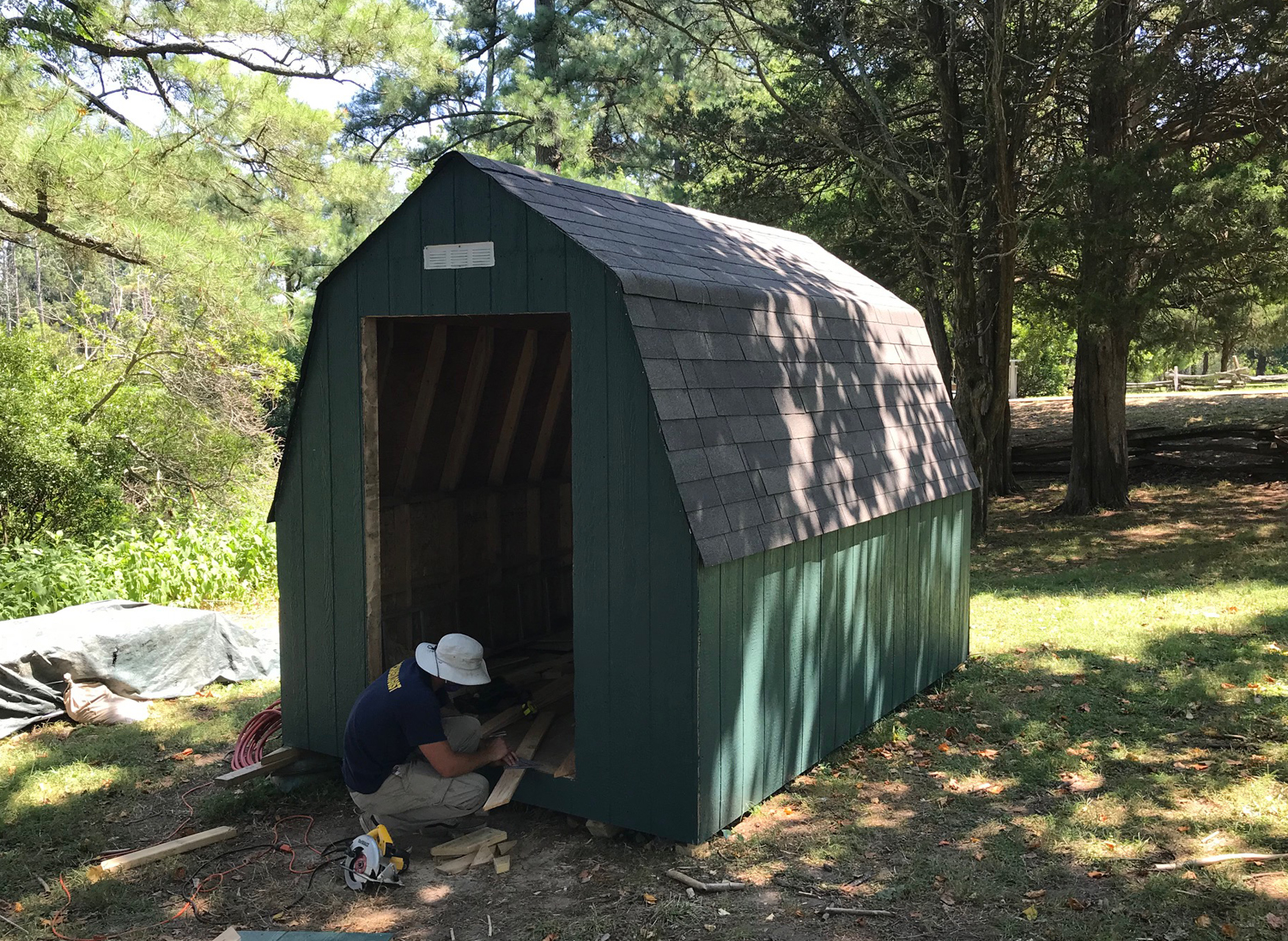
Finally, we are nearly done with the construction of our new tool shed. It has already been painted, and the doors and trim are being installed. Once those are done, we will be adding built-in shelving, and then moving over all of our tools. Our current shed is a bit worse for wear, so we are very excited to get the new one finished.
As you can see, we have a lot going on at Historic Jamestowne lately. Hopefully you will be able to come and see us in person!
related images
-
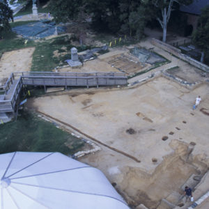
- Our current excavation area south of the Memorial Church, ca. 1999
-
- When the excavations were concluded around 2000, a large amount of backfill was placed over the excavation site south of the Memorial Church
-
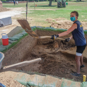
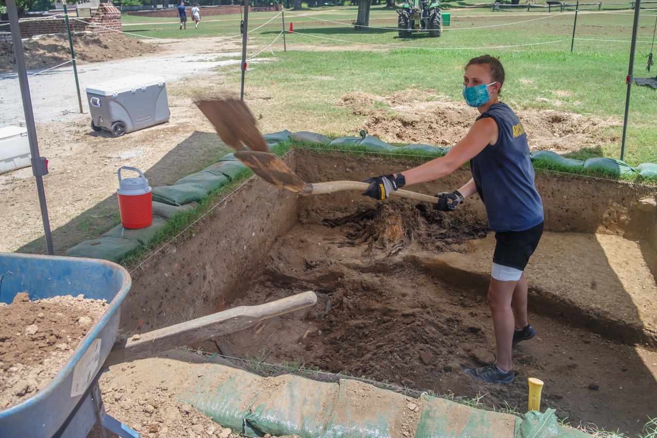
- Removing backfill by hand is hard work.
-
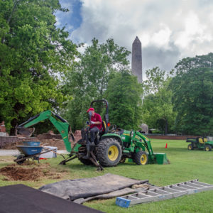
- The team broke out the heavy equipment to take some of the backfill away.

-
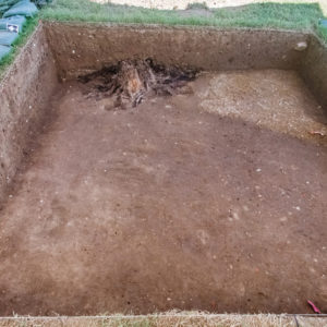
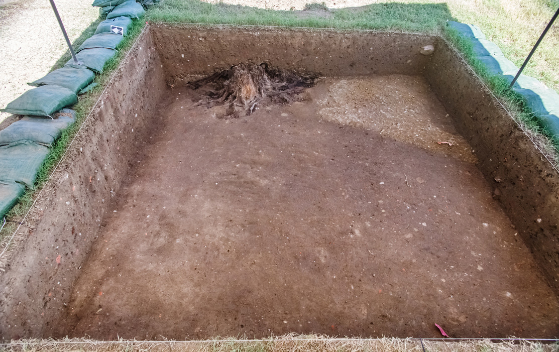
- In our current excavation area, the tree stump and gravel path represent a previously unexcavated space.
-
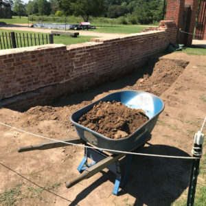
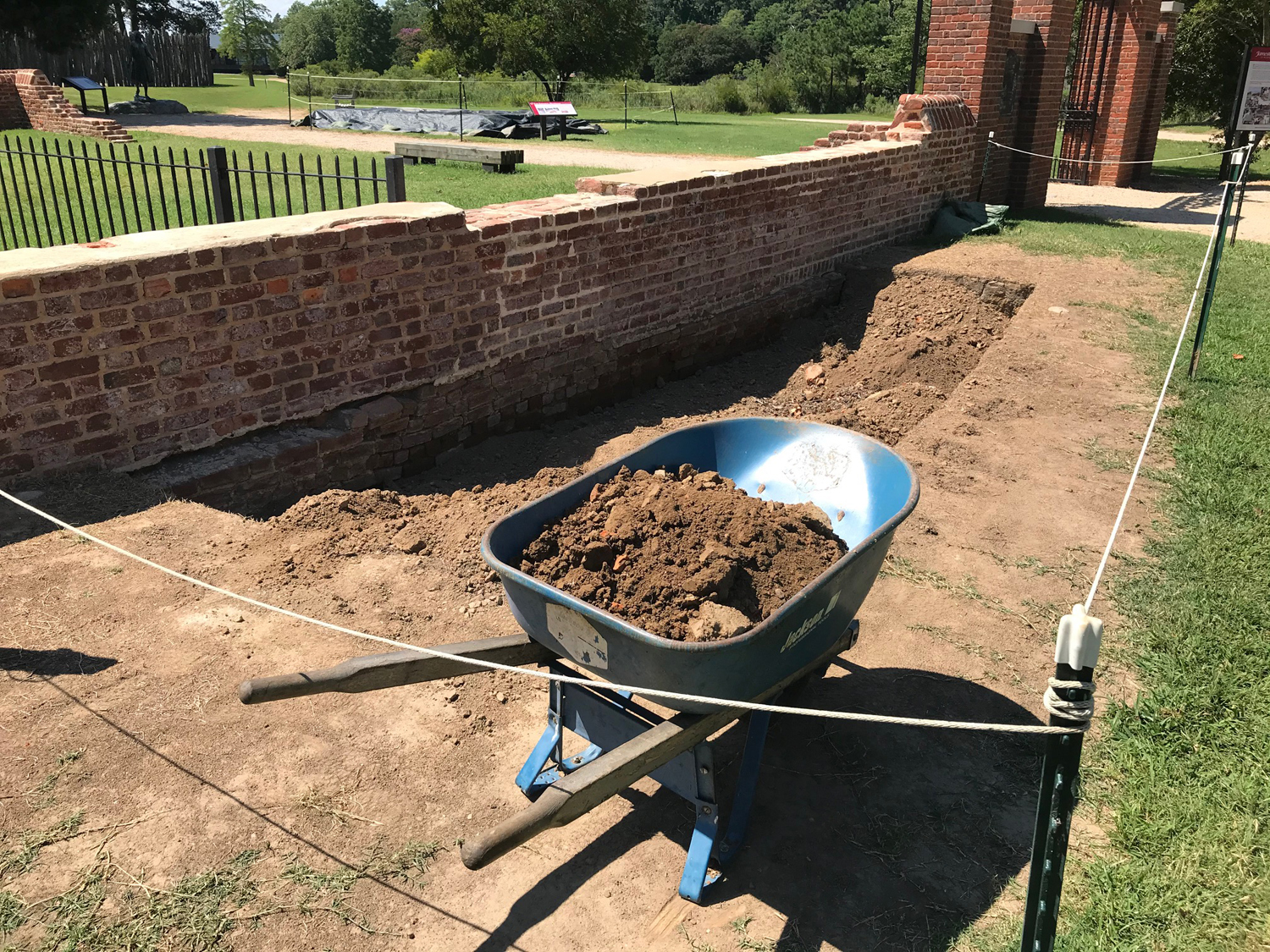
- The soil removed from south of the Memorial Church is being used to fill in our excavation area east of the churchyard.
-
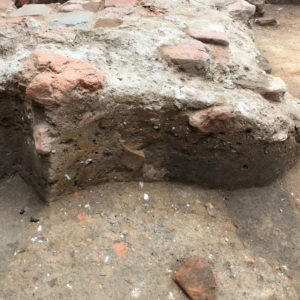
- This photo shows a burial found just west of the brick pad marking the original entrance to the 1639 Church. The burial is capped by grey mortar associated with the pad.

-
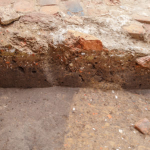
- The same profile, cut back a few inches. Here the grey mortar clearly covers a deposit of yellow clay (left) and debris-filled soil.

-
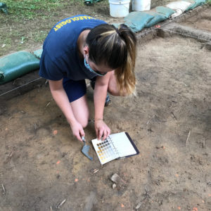
- Archaeologist Nicole Roenicke recording the color and texture of soil behind the Archaearium.

-
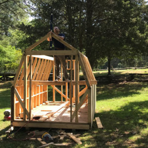
- Archaeologist Ryan Krank preparing to install the roof on our new shed.
-
- The new shed after painting.
-
- Director of Archaeology David Givens preparing to run GPR across the child burial.
-
- Getting the GPR antenna set up.
-
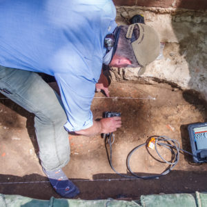
- Scanning the burial. The unprocessed results of the radar scan can be seen on the screen in the right of the image.