July and August have been busy months for the Jamestown Rediscovery team. Since our last Dig Update, we have opened two new excavation areas—along the Seawall and in the Churchyard—and continued our other two digs east of James Fort and behind the Archaearium.
The Seawall was built in 1902, and was intended to stop erosion along the western end of the island. Engineer Samuel H. Yonge supervised the construction of the Seawall. While working on the project, he noticed archaeological features in the eroded south shore of Jamestown Island. Yonge took notes on what he saw, eventually publishing a book, The Site of Old “James Town,” 1607-1698, discussing the finds and his interpretations of the history of Jamestown.
The Seawall has done its job well, preventing any further erosion of the western end of Jamestown Island. In fact, the Seawall likely saved the original James Fort site from being completely destroyed: the erosion prior to 1902 had removed enough of the shoreline to reach the southern end of the 1607 Fort site.
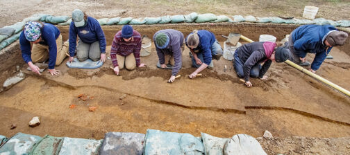
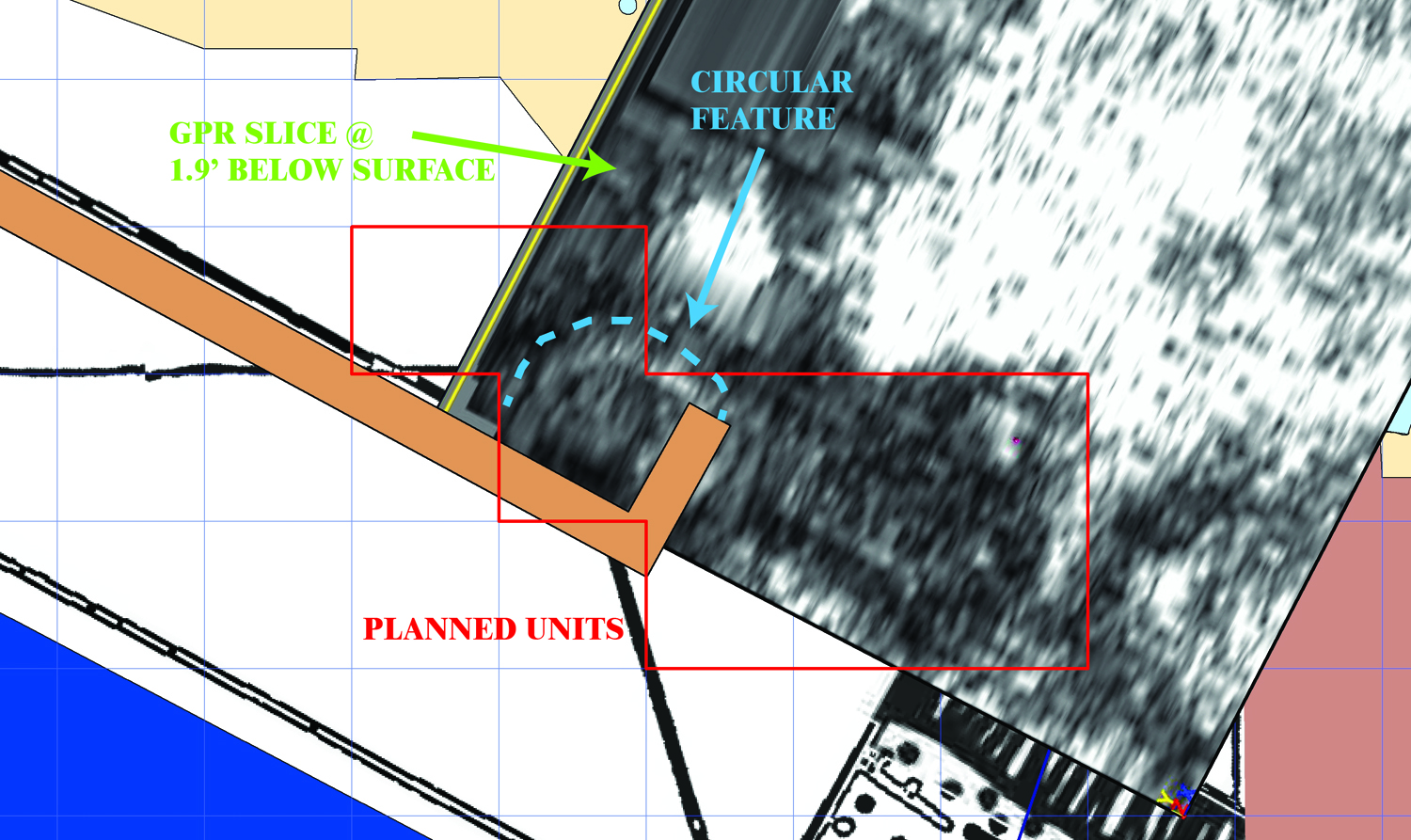
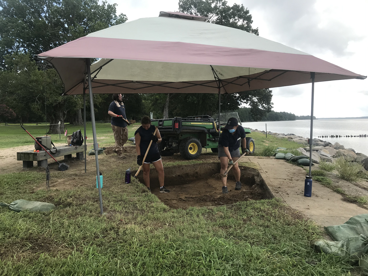
The Jamestown Rediscovery team is excavating along the Seawall for a few reasons. First, we want to assess the status of the Seawall. After 118 years, we need to make sure that its structural integrity is still sound, and to determine if any sections need repair. Second, as Yonge reported in his book, there are archaeological features right up against the Seawall, many of which have not been previously exposed or examined by the Jamestown Rediscovery team. A ground-penetrating radar (GPR) scan of the area where we are now digging—at the southeast end of the Seawall, near the East Bulwark of the 1607 Fort—showed a large rounded feature abutting the Seawall. We are excited to see what this rounded feature is, and have opened up a test unit directly atop it. Right now we are still in modern fill, but we are expecting to expose this and many other features very soon.
The Seawall dig sits at the southern end of the large area excavated back in the late 1990s, when the Jamestown Rediscovery team was still uncovering the footprint of the 1607 Fort. In fact, a tiny part of the rounded feature seen during the GPR survey was uncovered in that excavation area, but was not identified at the time. We are still using a backhoe to remove our backfill from the northern part of this space, just east of the 1607 Fort and a short distance south of the Memorial Church. Once the nearly three feet of backfill is gone, we will be digging into a previously unexcavated space and reexamining several nearby features.
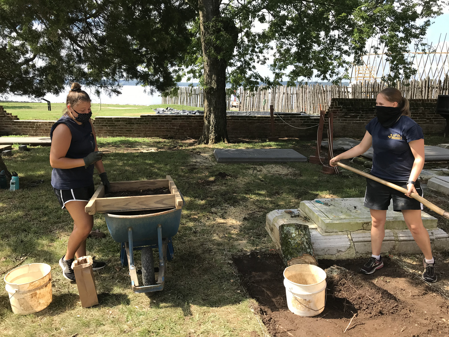
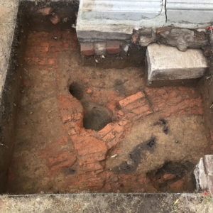
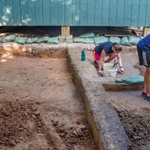
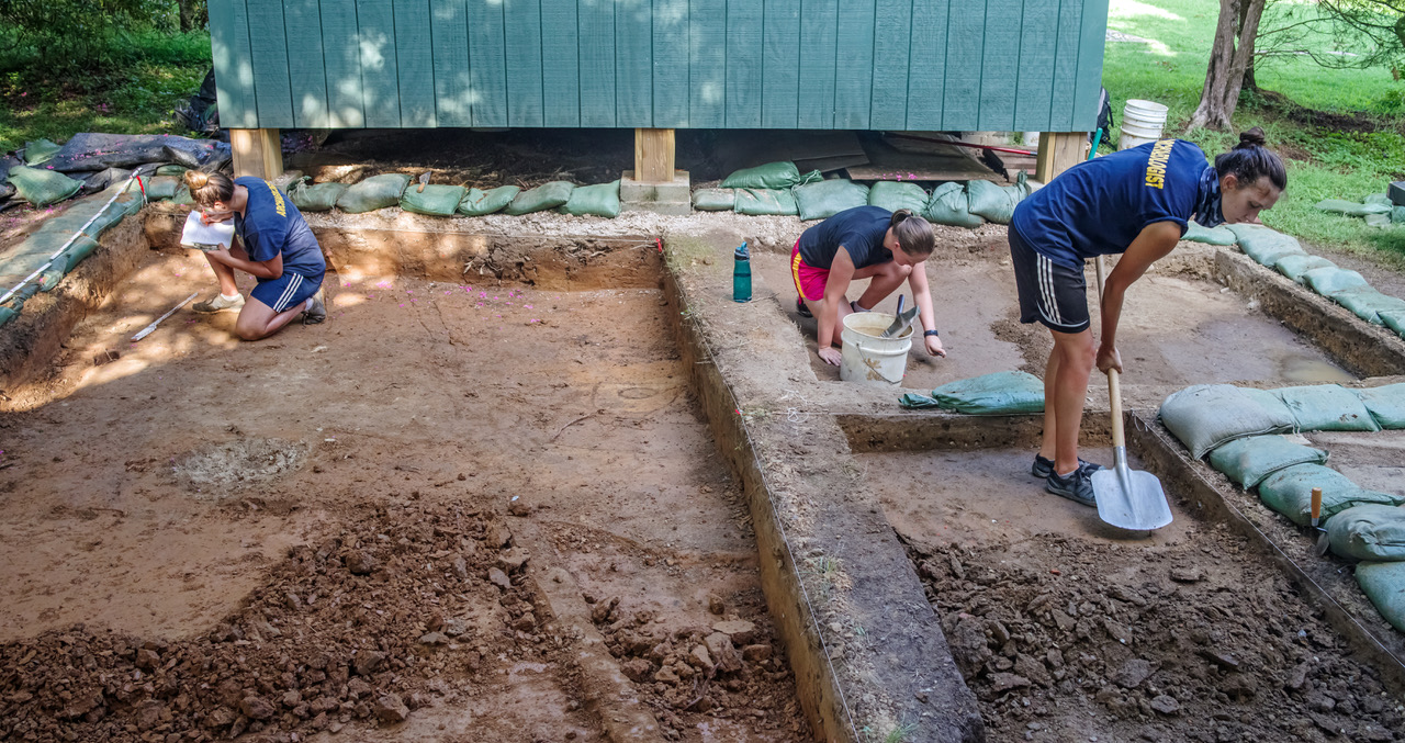
We have also continued excavations behind the Nathalie P. & Alan M. Voorhees Archaearium, our on-site museum. So far, we have identified three groups of features. Once we removed the topsoil and plowzone—soil that has been mixed together and homogenized due to historic plowing—we found several plowscars. These features are created when the point of a plow cuts slightly deeper into the soil than the rest of the blade, leaving behind narrow, linear streaks of plowzone. When you find plowscars in an area, you know for certain that it was farmed at some point in the past.
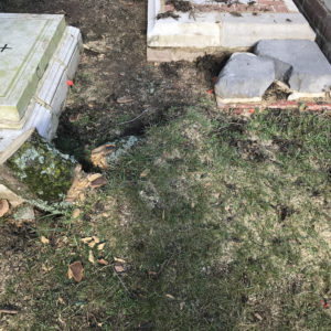
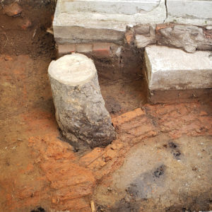
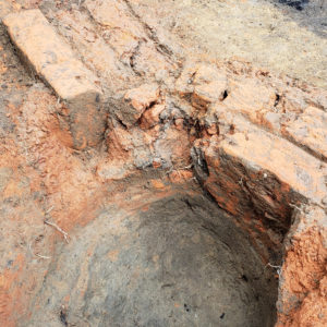
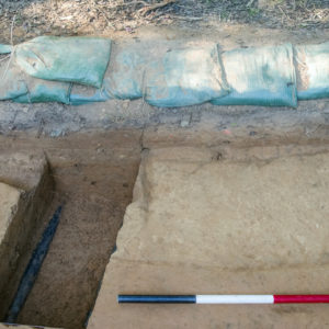
Also found under the plowzone was a single human burial. This was unsurprising, as we are digging near the large 17th-century burial ground on Statehouse Ridge. As we continue excavating behind the Archaearium, we might find more burials, but so far have only uncovered this one. Unfortunately, the burial has been cut through by a modern utility trench. This utility was installed sometime prior to the start of the Jamestown Rediscovery project, which began in 1994. Had the utility been put in after the project started, we undoubtedly would have done excavations across the path of the power line, to make sure no burials or other features would be impacted. The only other feature we have conclusively identified so far is another utility trench, this one containing telecommunication lines. We are hoping to wrap up excavations behind the Archaearium in the next few weeks, and may find more features in that time.
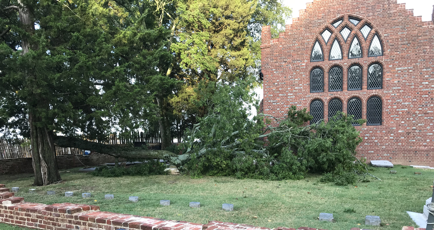
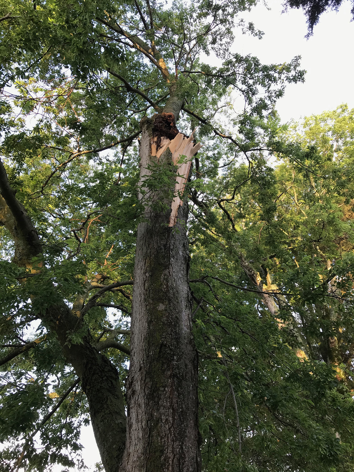
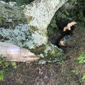
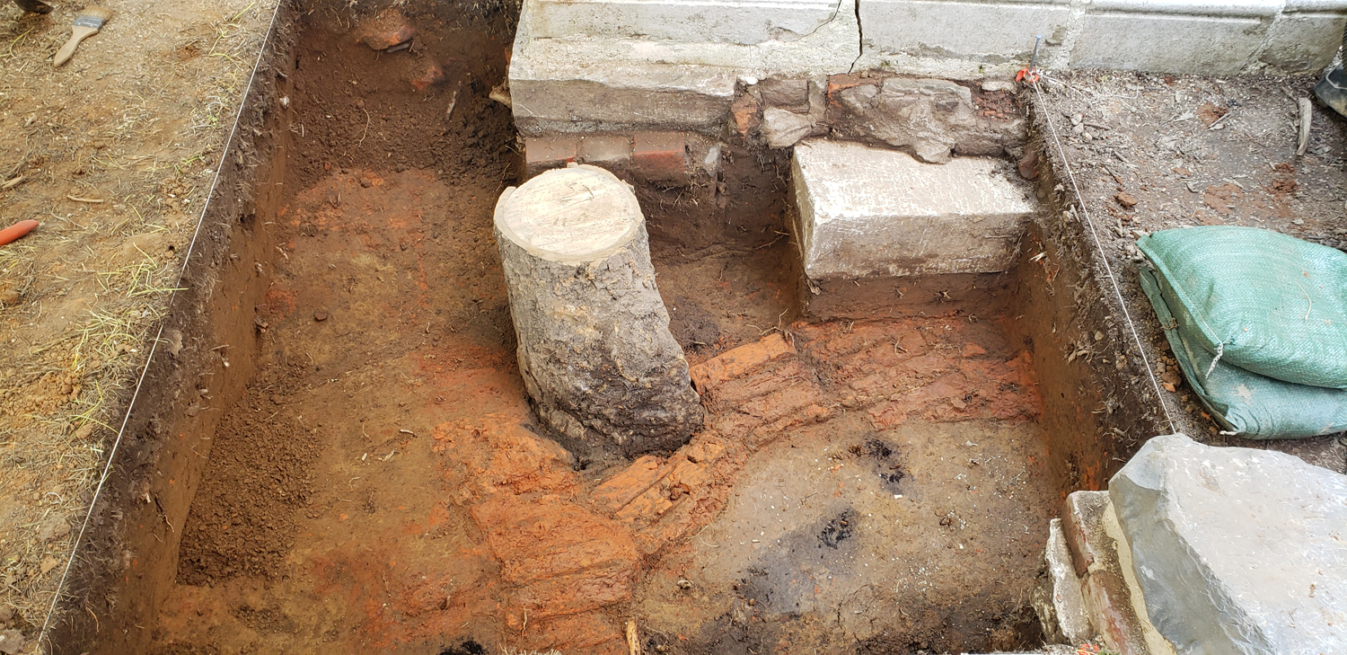
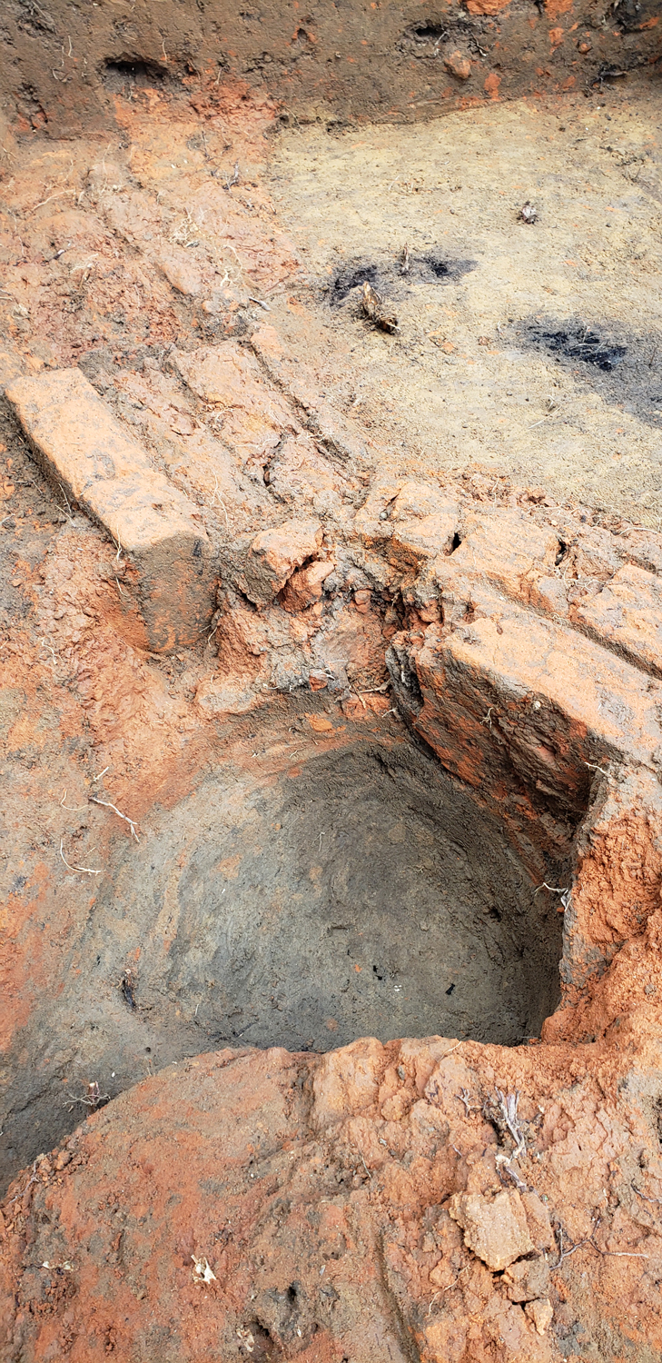
Finally, we have been excavating in the Churchyard east of the Memorial Church, within the area bounded by the late 18th-century churchyard wall. The Churchyard would have been used as a burial ground throughout the lifetimes of the 1617 Timber Frame and 1639 Brick Churches, both of which were located at the Memorial Church site. At the end of July, an overnight storm knocked over part of a hackberry tree in the Churchyard. The trunk fell across several tombstones, but thankfully caused no damage. However, a sizeable limb became embedded in the ground. To determine if the limb had caused any damage to burials or other subsurface archaeological features—and to get it out of the ground—the team opened up a small 5’ by 5’ excavation around the branch.
What we found was unexpected. At about 1’ below the ground surface, we encountered dry-laid (unmortared) bricks laid on end. The bricks were clearly hand-made, and were very soft, crumbling to the touch. Some were just red dust in a brick shape. None of the bricks had any mortar on them at all, indicating that they were not recycled from another structure. They also formed a meandering pattern across the excavation area. At first, we were not sure what they represented, but closer inspection of the bricks and surrounding soil told us that this was an old pathway that had been cut through by 17th- or 18th-century burials. The intact brickwork was the portion of the pathway left undamaged by subsequent burials. Because the bricks were so soft, they were cleanly sliced through by the people who dug the burial shafts, leaving the burials perfectly outlined by the remaining brickwork.
The last month has been a busy one for us! We should be wrapping up the Archaearium and churchyard excavations soon, but the digging east of the 1607 Fort and at the Seawall is just beginning. We should be finding some exciting things in both locations very soon. The Archaearium is once again open to visitors, so no matter when you come to the site, you will be able to see some great artifacts!
related images
-
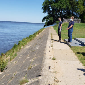
- Director of Archaeology Dave Givens and the team planning excavations at the Seawall

-
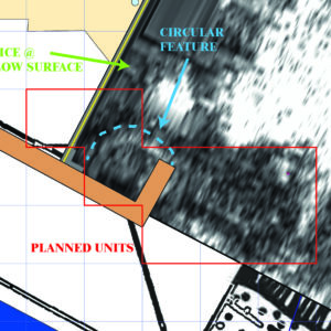
- The Seawall excavation area, with the round feature highlighted. The orange line is the top of the Seawall
-
- The team starting excavations at the Seawall
-
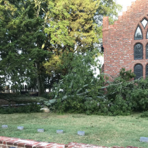
- The fallen tree in the Churchyard
-
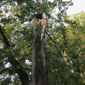
- The break point on the hackberry tree
-
- This is the tree limb that embedded itself in the ground

-
- The tree limb, after the rest of the fallen tree has been removed

-
- The tree limb embedded in the remains of the brick path
-
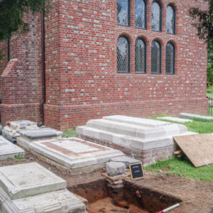
- The excavation are in the Churchyard relative to the Memorial Church

-
- The brick path and burials. The soil areas are where burials (and possibly other featres) have cut through the path

-
- The hole made by the tree limb
-
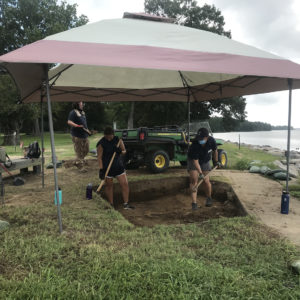
- The team digging behind the Archaearium
-
- The utility trench (with a conduit) cutting through a historic burial (outlined) behind the Archaearium