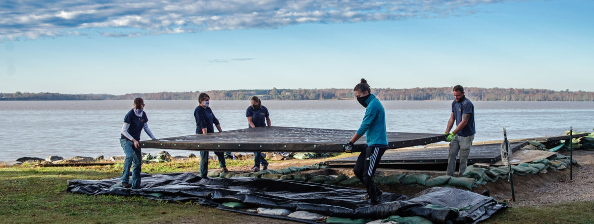
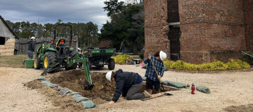
This holiday season we have a lot on our plates! The team is still hard at work at both the Ditch 8 and Seawall sites, and has begun to uncover 17th-century features.
At Ditch 8, the team has completed two out of their four test units. As the final two squares are excavated, we continue to assess the features we have uncovered. So far we have what appear to be at least two separate ditches as well as a 17th-century pit feature. It is hard to determine the exact boundaries of the features; even though we have excavated down to subsoil (sterile soil), the edges of the features are extremely subtle. In some features, such as the pair of historic burials we have identified, this subtlety is because of how the features were created. Originally, they were dug down into the subsoil and then backfilled with the same material, so the soil colors and textures for the burials and subsoil are very similar. For some of the other features, only small portions have been uncovered, which makes identifying their boundaries even more difficult. Once we get down to subsoil in our current two test units, we will have a fuller picture of the features at Ditch 8.
Some of the features we have found at Ditch 8 were partially excavated during past field seasons. One of these, a large pit, appears to date to the mid-17th century. For the other features that have not yet been excavated, we do not have specific dates. However, future testing could uncover artifacts that would give us a better idea of when exactly these features are from.
One thing we do know, is that even though this excavation area is directly between the 1607 and 1608 palisades, the ditches and pit do not appear to be a part of the early James Fort period. Instead, they are likely from slightly later in the 17th century, once Jamestown begins expanding into a port city. Walls, roads, ditches, and other landscape features are often aligned with nearby structures. Most early buildings at Jamestown are aligned with the palisades of James Fort, for example. However, the ditches found in the Ditch 8 area are not aligned with the Fort, indicating they date to after the palisade was deconstructed.
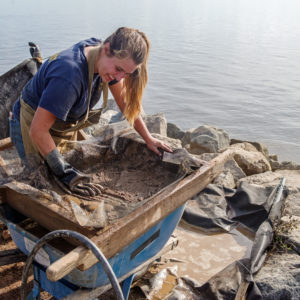
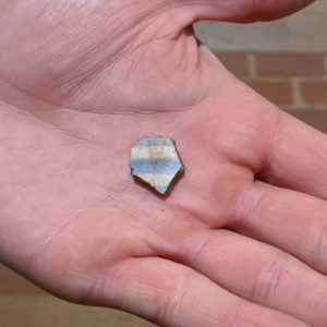
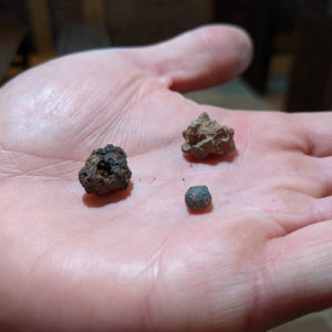
Last month, we uncovered a dry-laid brick foundation at our Seawall excavation area. More rubble has been exposed around that foundation over the last few weeks. This rubble is likely from where the wall collapsed, and was subsequently buried by historic fill. Since the historic fill is artifact-rich, and it sits on top of a 17th-century trash pit, we are water-screening the soil coming out of this area to make sure we do not miss any smaller artifacts like fish bones, lead shot, beads, etc. So far we have found items such as slag (byproduct of metalworking), different types of pottery (locally-made redwares, delft), tobacco pipes, different sizes of lead shot, lots of charcoal, and some animal bones.
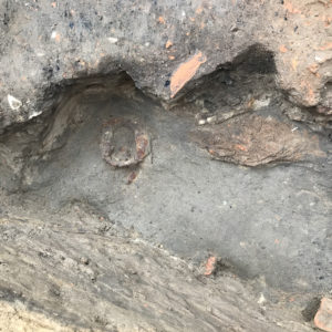
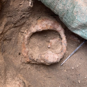
Underneath the trash pit and building is a layer of sand, in which we recently uncovered a large, circular, iron object. After it was removed and taken to the lab, the team was able to determine that it was a stirrup for riding a horse! We are excited to see what other artifacts come out of this sand, which may be related to a hurricane from the 1660s.
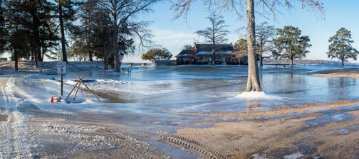
The exposed foundation lies on the riverbank of the late 19th century, but the land extended much farther into the river in the 17th century. It seems that parts of the wall were eroded away when the area was exposed to the river. Before the Seawall was built in 1902, there were many attempts to stop the eroding shoreline by dumping fill onto the banks. Each of these endeavors was temporary and unsuccessful, leading to the construction of the Seawall by the Army Corps of Engineers. While the West Bulwark was unfortunately already cut away by the river when the Seawall was built, the majority of James Fort has survived due to its construction and continued maintenance.
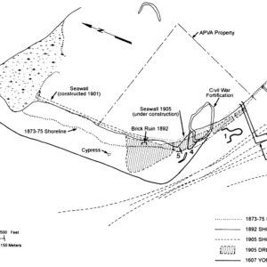
After 118 years, the Seawall is still the island’s main defense against erosion and rising sea levels. Prior to the Seawall, it is estimated that at least 100 yards of lateral land has been lost since the founding of James Fort. The map below estimates the changes of the river bank over the past 400 years based on a study from 1994.
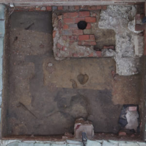
Due to other archaeological projects across the island, the South Church Door excavation site was temporarily put on hold during the summer. Now, the team has been able to finally revisit the area to wrap up excavations. During the dig, the brick pad entryway of the later brick churches was uncovered along with the tops of several burials. The site will be backfilled after all of the record photographs have been taken and all of the soil profiles have been drawn.
related images
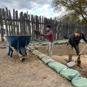
- Site Supervisor Anna Shackelford and Archaeologist Natalie Reid dig through modern gravel overtop of the intact fill at the Ditch 8 site.
- Staff Archaeologist Nicole Roenicke water-screens historic fill from the Seawall site.
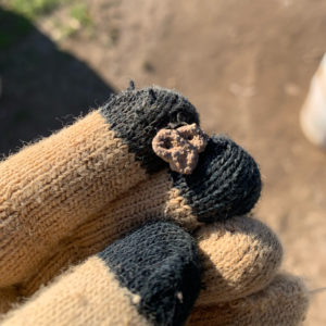
- A fragment of animal bone found while water-screening historic fill.
- A sherd of delftware found while water-screening historic fill.
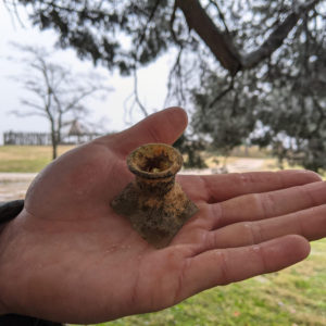
- The top of a case bottle found in material that had been dredged from the James River to build up the shoreline prior to the Seawall.
- Some pieces of slag (byproduct of smelting metals) found while water-screening historic fill
- A button that was found in another layer of dredged fill by the Seawall.
- An image of the stirrup in situ before its removal. It is located in sandy wash, possibly the result of a hurricane. The layer above is the trash pit that was exposed earlier.
- A closer image of the stirrup in situ. After it is taken to the lab, the conservation crew will work on stabilizing the iron and removing corrosion.
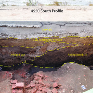
- The south profile of Test Unit 4550 at the Seawall site. Outlined are the strata the team has had to dig through and identify, including material related to the construction of the Seawall as well as various layers of dredge and fill deposited to build up the shoreline.
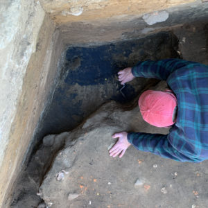
- Senior Staff Archaeologist Sean Romo trowels a fine, black sand at the Seawall site. This sand may also be related to the 1660s hurricane.
- A map displaying the changes of the shoreline over the past 400 years (Hobbs et al. 1994). Hobbs, Carl H., Dennis B. Blanton, Robert A. Gammisch, and John Broadwater 1994 A maritime archaeological reconnaissance using side-scan radar, Jamestown Island, Virginia, U.S.A. Journal of Coastal Research 10(2): 351-359.
- An overhead screenshot of the rendered 3D model for the South Church Door unit. Features of interest include the brick entry pad of the brick churches as well as a number of burials.


