Though the holiday season may slow down our excavations for a short time, there are still plenty of projects to complete across the island! For the past couple of months, we have been chipping away at a ground-penetrating radar survey (GPR) of the entire Seawall in order to assess whether any part of it is in need of repair. Within the past century the river has undercut some sections, weakening the structural integrity of the Seawall. After identifying problem areas, we will be able to come back and repair weaker sections of the Seawall, preserving the current shoreline and this historic structure.
Samuel H. Yonge and the Army Corps of Engineers designed and built the Seawall at the start of the 20th century to protect the island from erosion. For hundreds of years, the James River has been washing away the shoreline, and erosion has been particularly bad at the bend in the river on the western corner of Jamestown Island. It is estimated that in some areas around 300 feet of land has been lost to erosion since the 17th century. The concrete Seawall has done an amazing job of protecting the island and the archaeology; but, because the Seawall is over 100 years old, it has some issues. Some of these problems include the cracking and slumping of the concrete, as well as the possibility of the river undercutting the Seawall.
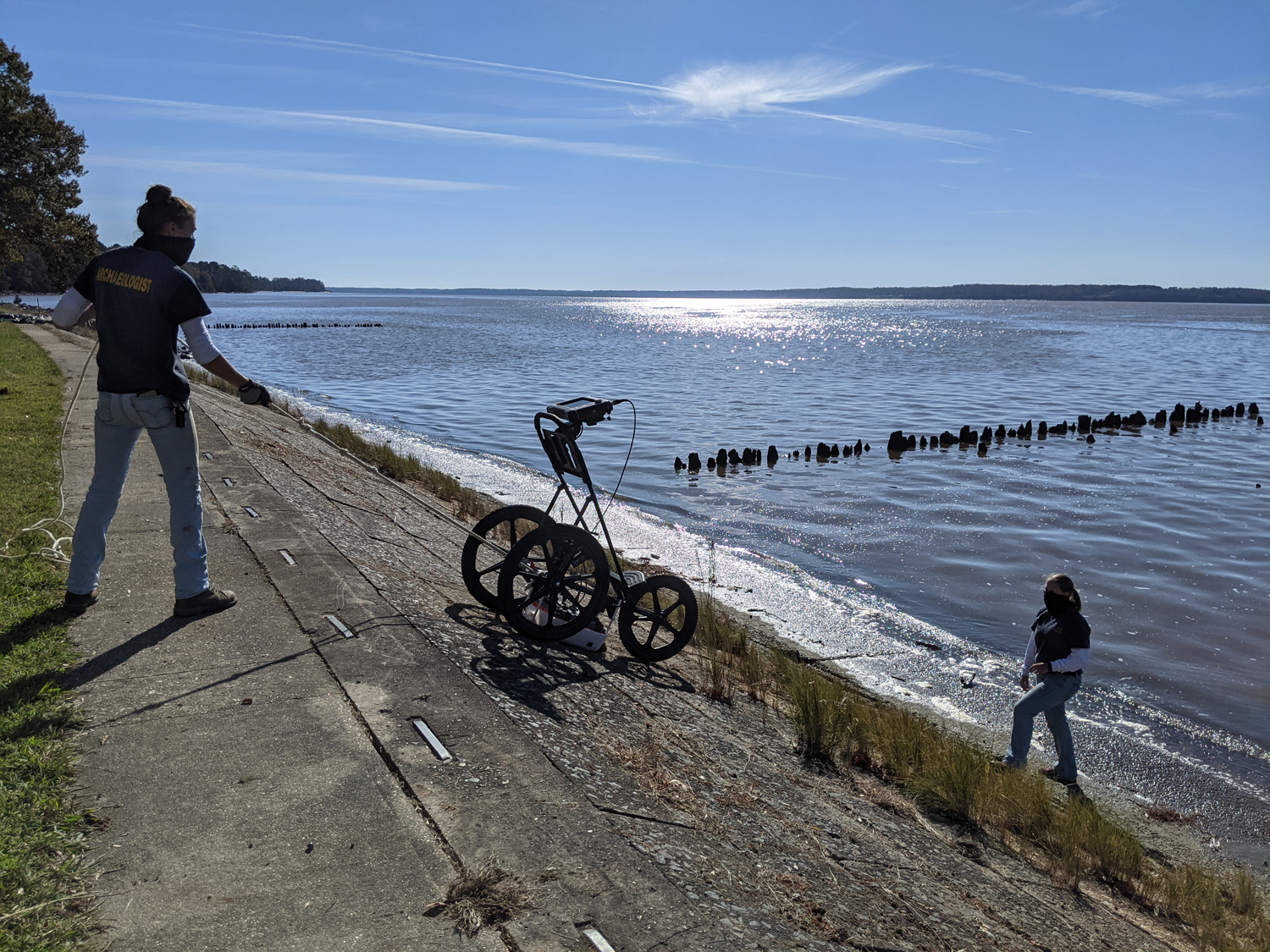
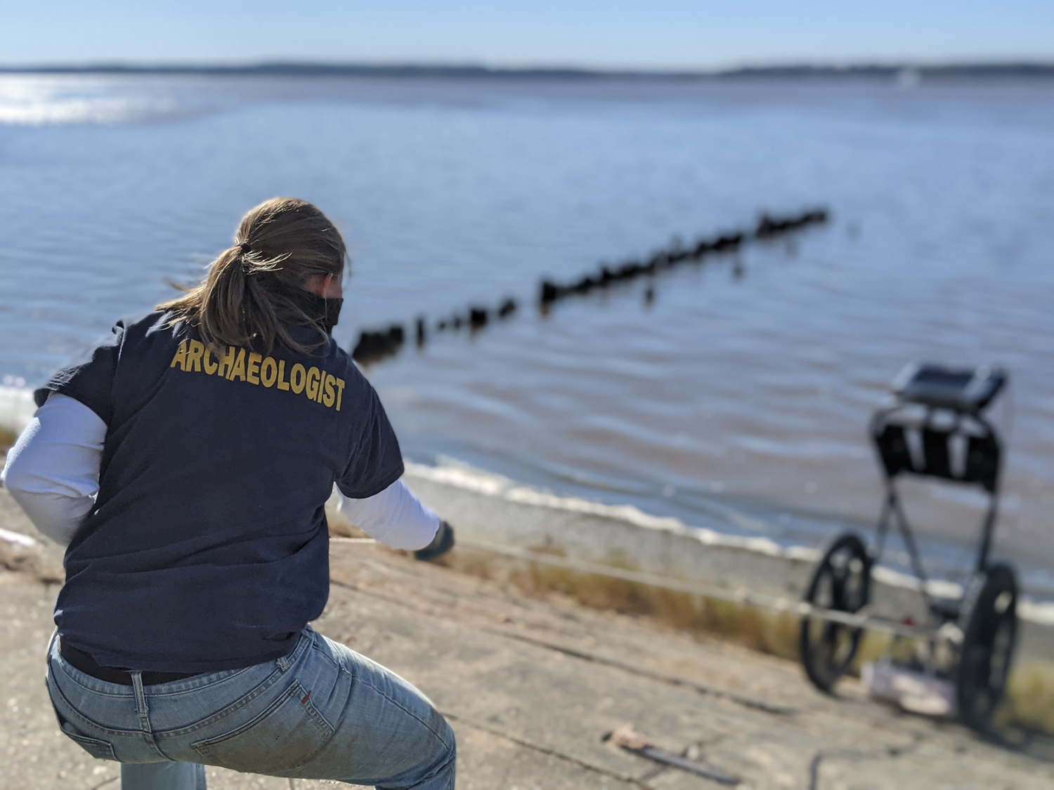
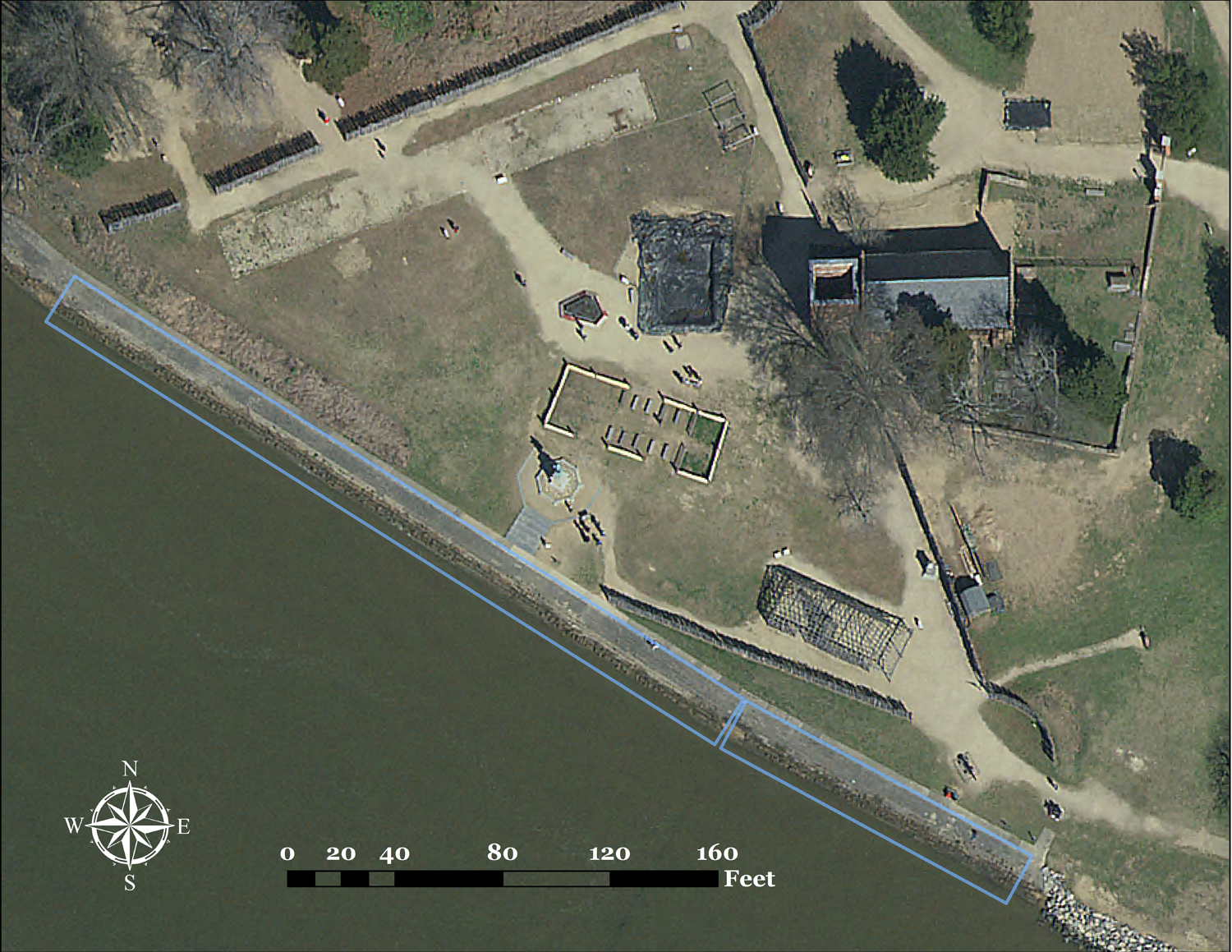
Using GPR, we can survey the 1700 feet of the Seawall to see if there are any voids beneath the concrete where soil is being eroded out into the river. Every two feet, the machine is pushed in a straight line down the Seawall, producing a complete view of the structural integrity of the wall and the soil beneath. So far, we have seen some sizeable gaps between the Seawall concrete and the soil below. By locating these, it makes it easier for us to isolate and fix these issues, protecting the island from further erosion.
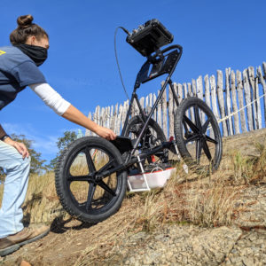
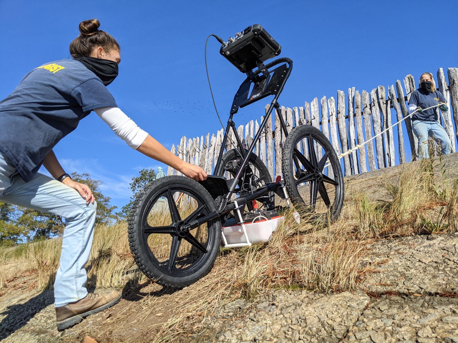
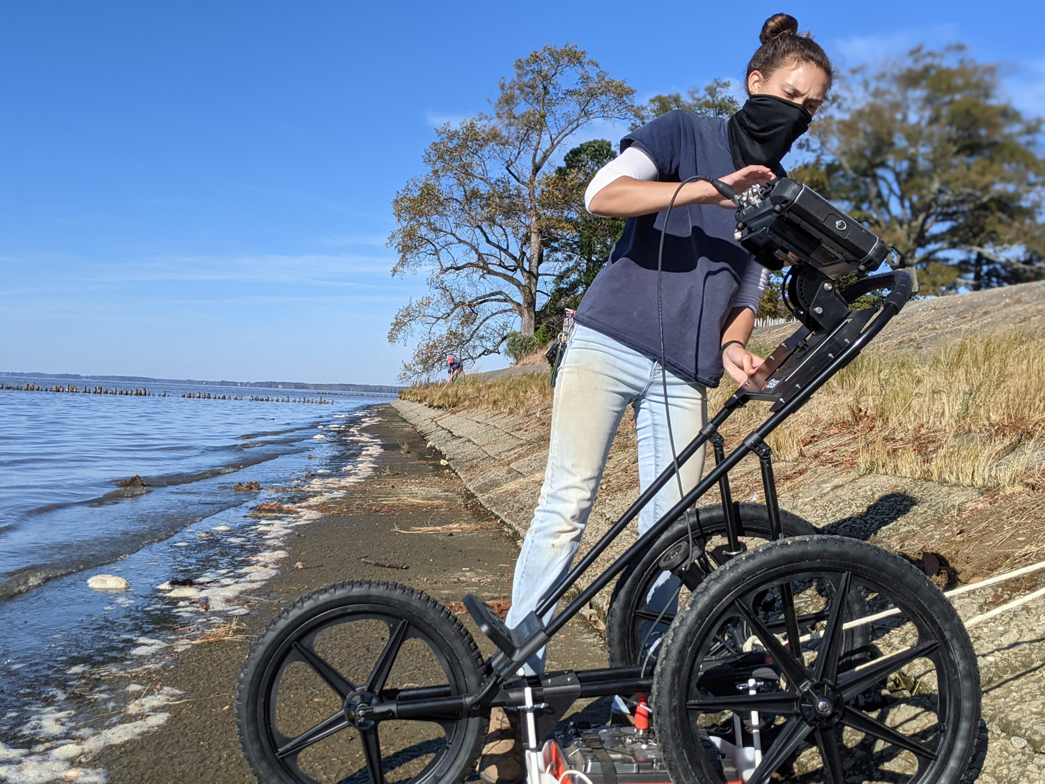
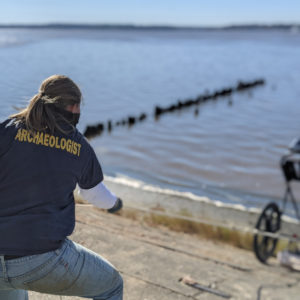
To complete the survey, we are rotating through teams of two archaeologists at a time. One person starts the survey at the top of the Seawall, lining up the GPR machine (for this project, a SIR-4000 with a 350 MHz antenna) over the joint between the first course of the Seawall and the adjacent sidewalk. This joint is our baseline, providing a consistent start point for the survey. This allows us to have an accurate measure of survey distance for each line we run along the Seawall. After everything is lined up, the team member up top begins slowly lowering the SIR-4000 down with a rope. Since the Seawall is sloped and gets very slippery, we are avoiding constantly walk up and down the face.
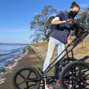
The second person stands carefully at the bottom, stopping the survey and ensuring that the SIR-4000 does not roll into the James River or get hit by waves. After hoisting the machine back up the face of the wall, the team moves down another two feet and the process starts all over again. Unfortunately, we only get a couple hours a day to work on the survey due to high tide submerging the lower courses of the Seawall, so we have to make the most of each opportunity we get. This is one of the reasons why the survey has been stretched out over a period of months.
So far we have completed approximately 400 feet of the survey, from the eastern terminus of the Seawall to near the Dale House Café. Throughout the coming months, we will continue to chip away at the rest of the Seawall survey whenever we have an opportunity to break away from our excavations.
We are also using the drone in these surveys; by taking photos from above, we can put our final survey results into perspective. These images will be added to our GIS map and georeferenced into their exact position. That way, we can overlay the survey results and potentially pinpoint exactly which blocks these voids are beneath, helping with isolating repairs in the long run.
related images
-
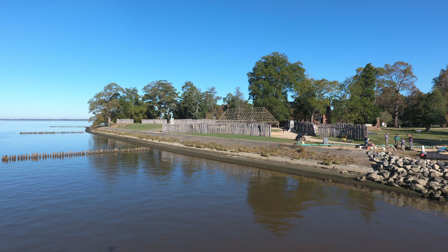
- A photograph of the eastern part of the Seawall taken with the drone. Two of the wooden groins added in 1894 in an attempt to prevent erosion are visible trailing off into the river from the Seawall.
-
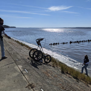
- Site Supervisor Anna Shackelford begins to lower the SIR-4000 down the Seawall where Archaeologist Caitlin Delmas waits to stop the survey.
-
- Site Supervisor Anna Shackelford keeps a hand on the SIR-4000 as Archaeologist Caitlin Delmas lowers it to the bottom of the Seawall.
-
- Site Supervisor Anna Shackelford ends the survey for one line before Caitlin hoists the SIR-4000 back up the Seawall and repositions it for the next.
-
- Archaeologist Caitlin Delmas pulls the SIR-4000 back up the Seawall after completing one line of the survey.
-
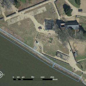
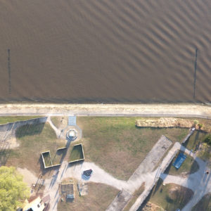
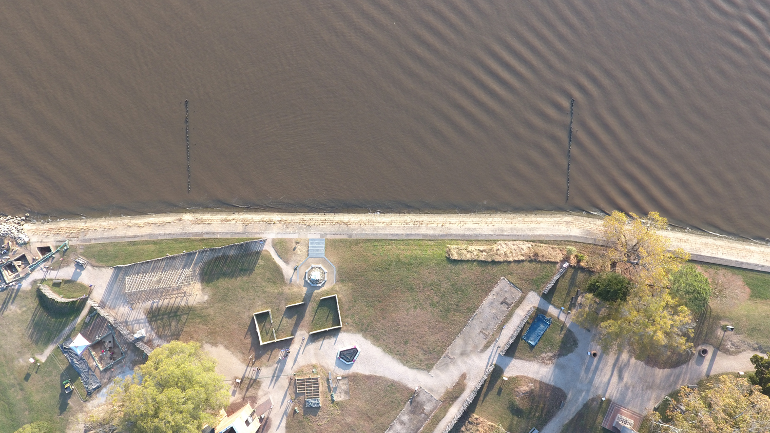
- Another drone shot of the eastern part of the Seawall. The outlined portions are the sections that have already been surveyed.
-
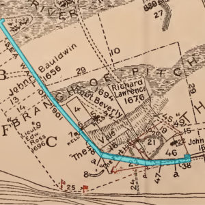
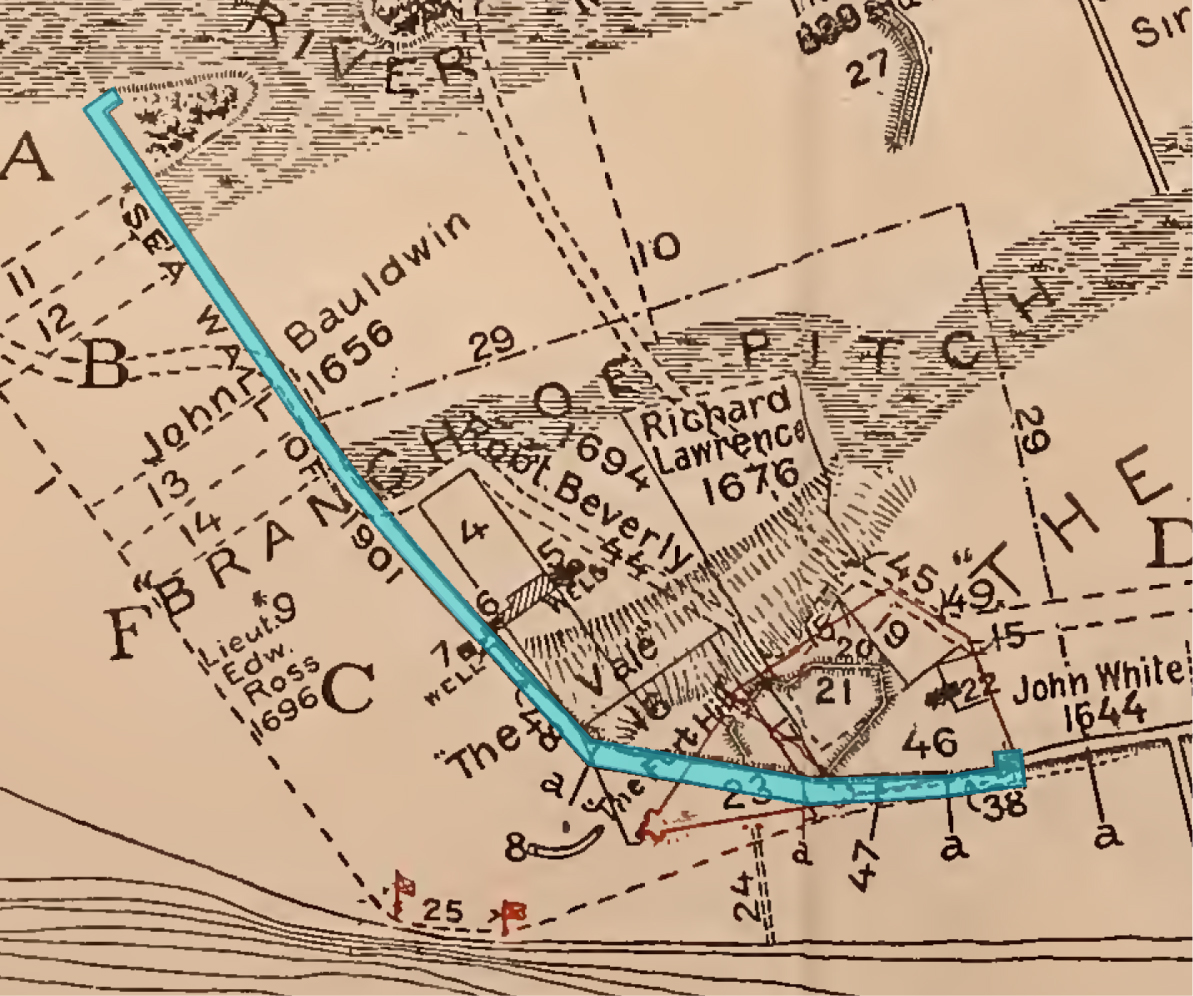
- A portion of a map drawn by Samuel H. Yonge in 1907 illustrating the estimated shoreline of the 17th century (Yonge, Samuel H., 1907 The Site of Old “James Towne” 1607-1698. The Hermitage Press, Inc., Richmond, Va.). The entirety of the Seawall, where the shoreline is today, has been highlighted.