Though the heat may dampen our shirts with sweat, it certainly has not dampened our spirits! We have made significant progress at both of our sites, and have even opened up a new excavation!
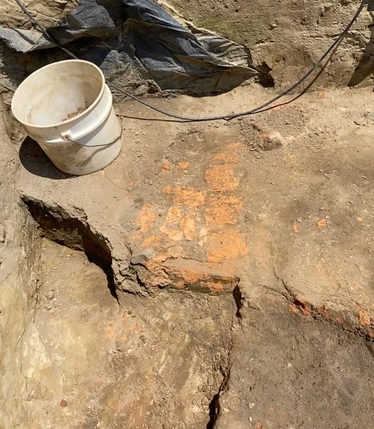
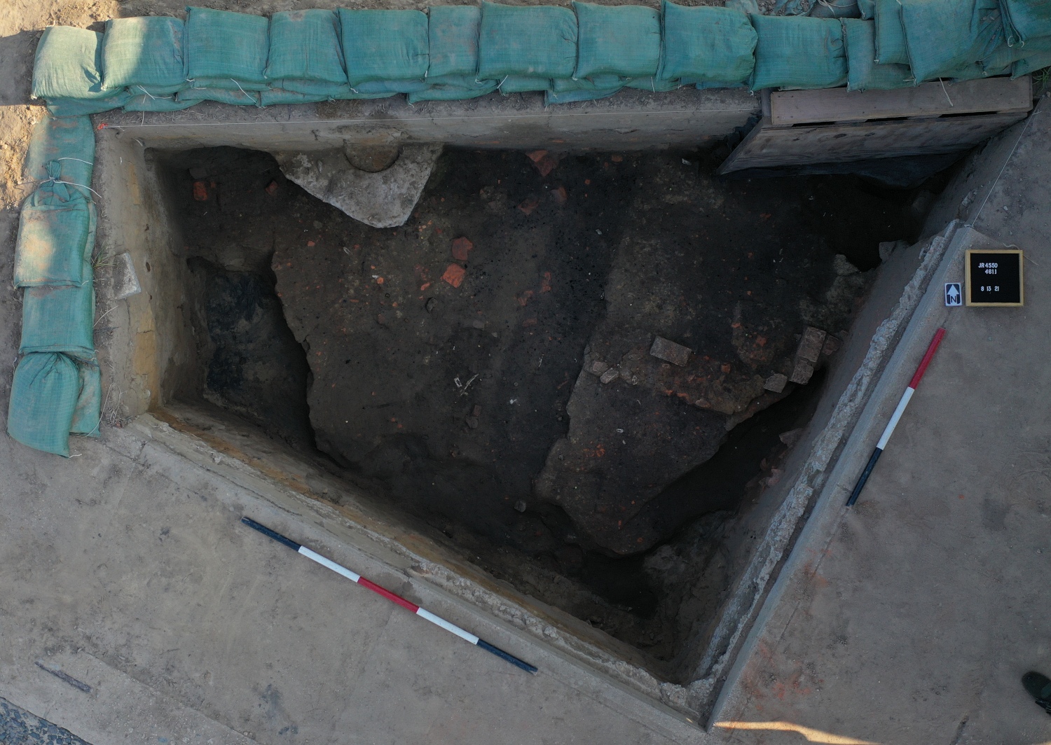
West of the Church Tower, we finished the two test units at the south end of the site. In those areas, we uncovered a number of modern post holes for multiple iterations of fences that enclosed the churchyard in the late 19th and early 20th centuries. In an effort to expose more of the limits of the possible brick walkway, we expanded our test area west. Unfortunately, a large portion of the fill within this area was disturbed by 20th-century post holes and the brick rubble that survived showed no discernible pattern. However, we were able to define the west limits for the possible pathway. After exposing the new section of brick rubble, a series of drone photos were taken and we removed it. Scattered across the top of the brick rubble and interspersed among it were pieces of window lead, nails, copper straight pins, and bits of European pipe stems and bowls. If we are lucky, some of these window leads may have dates on them and give us further clues to the dates of this brick pathway. Currently, we believe it was built in the late 17th or early 18th century is likely associated with rebuilding after Bacon’s Rebellion. With the brick path gone, we will continue to excavate down until we reach the burned layer and define the limits of that deposit.
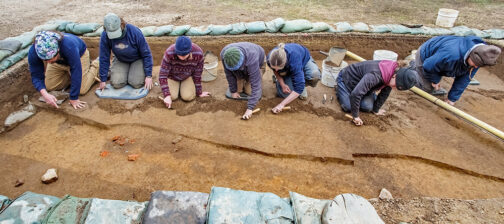
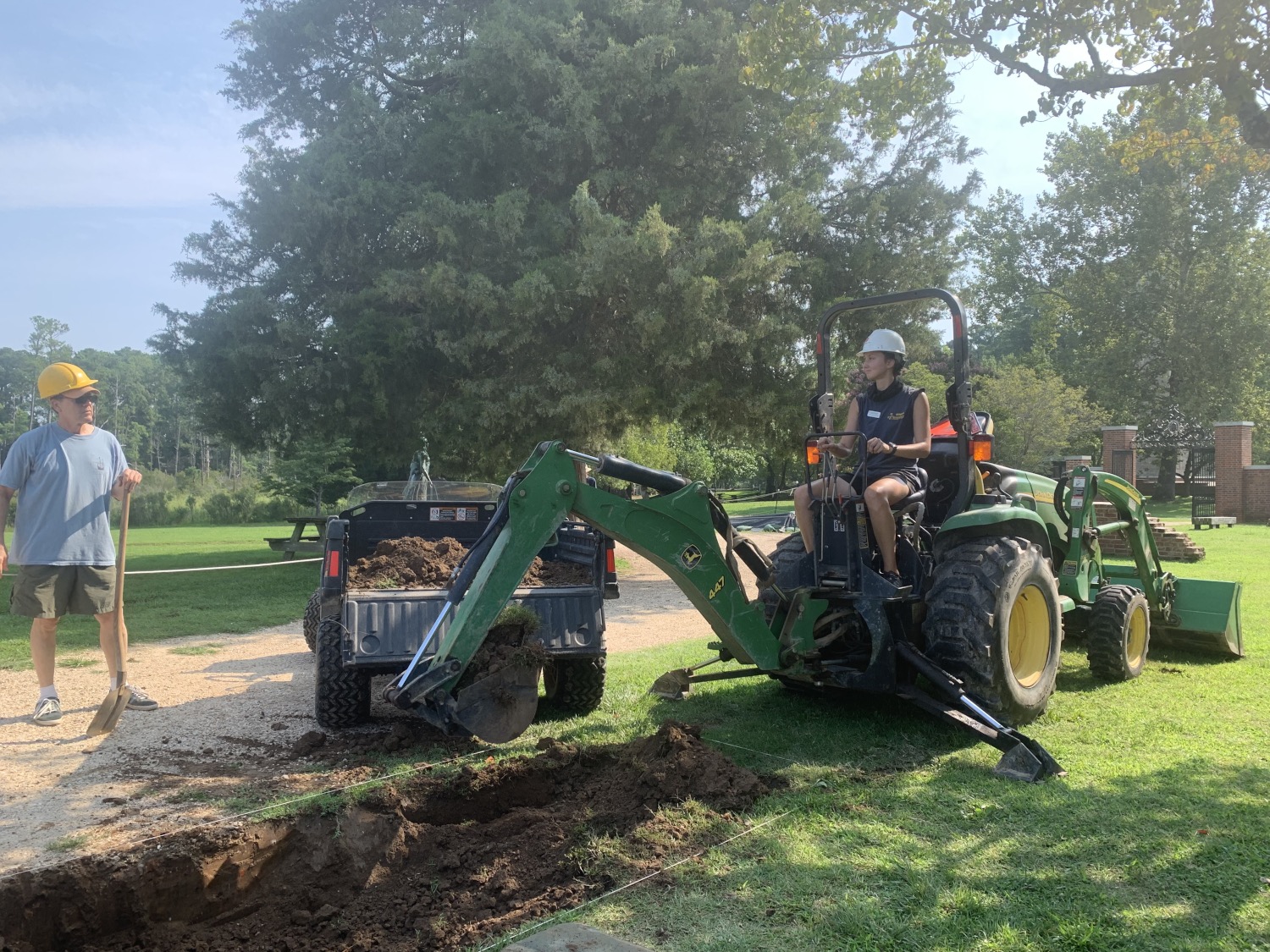
We are now focusing on the north side of the Church Tower, as well! This new site has been opened up in order to expose the southern half of a circular pit feature that was partially exposed in 2016. Excavators troweling across the top of the feature unearthed several military artifacts including iron brigandine armor and jack plates, a trigger guard for a snaphaunce, and a bullet mold. Roanoke simple stamped pottery sherds, from pots used to cook the food items that the Powhatan peoples traded with the colonists, were also recovered from the surface of the pit. A folded copper jetton, a blue Nueva Cadiz bead, local and European pipe bowls and a small lead-glazed Border ware colander handle were also found. All of these items suggested that this feature might have been abandoned in the first few years of Jamestown’s occupation (ca. 1607-1610) and the team has been anxious to study the pit in more detail.
So far we have removed the backfill from the original 2016 excavation. The profile of the pit was visible in the wall of the original test unit. That profile showed the pit was cut through the historic topsoil for Jamestown Island, and was capped by a deposit of brick rubble. This rubble may be a continuation of the possible pathway discovered west of the Church Tower earlier this summer. A second test unit is planned to expose the southern half of the pit feature. The combination of discarded English armor and the Native American ceramics recovered from the pit thus far make this a very interesting feature. These types of artifacts typically only occur together in features dating to the first two or three years of the Jamestown colony, prior to the outbreak of war with the Powhatan. This pit has the potential to highlight how the English and Powhatan interacted in the initial years of settlement.
Down at the Seawall excavation site, work has continued in all three of the test units. In the western-most test unit, both foundations were removed. The bricks in these foundations were laid in two different styles, and neither foundation incorporated mortar. Instead, they were bonded with clay or redeposited midden soils. The artifacts recovered from these soils will help date the foundations. Right now, we think they date to around 1650. With the foundations removed, we can excavate into the layers of midden beneath. Hopefully, there will be some James Fort features intact below the midden!
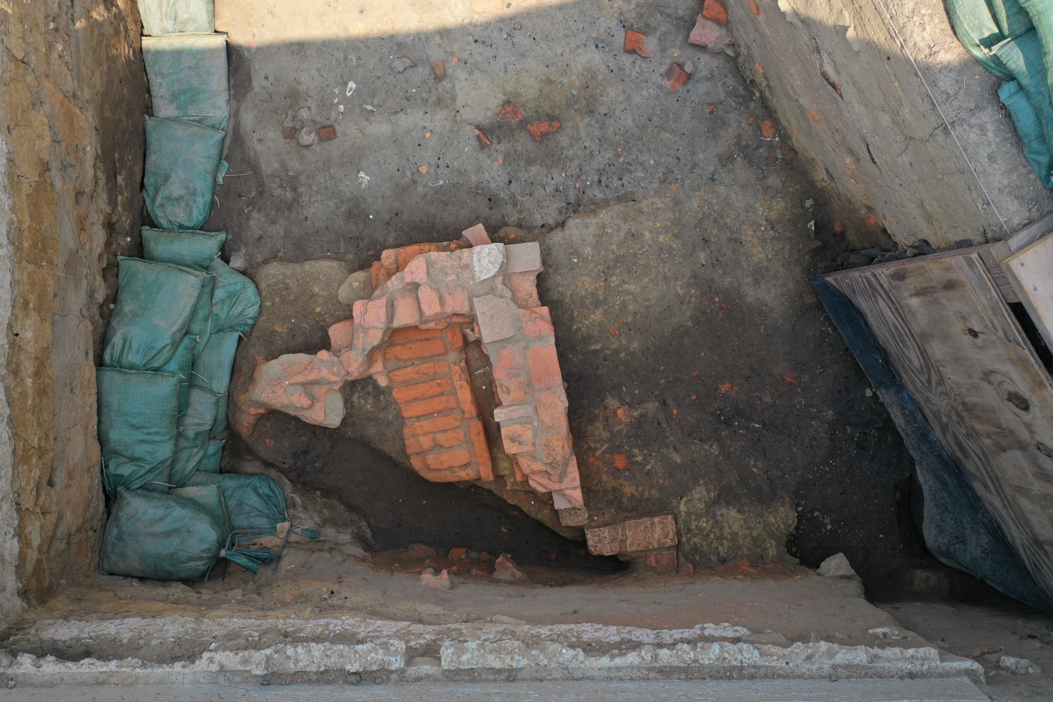
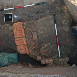
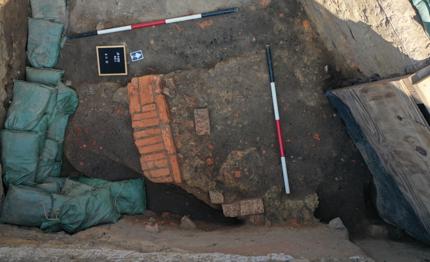
In the central Seawall test unit, the team has come down on a layer of brick rubble. Elsewhere, this rubble layer capped the very top of the midden. These bricks seem to be related to the neighboring John White warehouse, which the team excavated about 20 years ago. As with the other two units, our main focus is to get beneath the bricks and the midden, to where intact James Fort features may remain. If we are lucky, we could see post holes for the palisade or evidence of the dry moat ditch around the outside of the Fort.
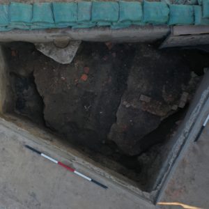
While the southern half of the test unit has been heavily disturbed by modern features like the Seawall and the 1930s septic tank, the northern half is promising. Among the brick rubble layer also seems to be part of an intact brick foundation. Though in poor condition, these bricks were undoubtedly laid purposefully and are separate from the rest of the debris. There is also a good chance that this foundation matches with one of those found to the west. Stay tuned; we should be finding some exciting artifacts and features in the upcoming weeks.
related images
-
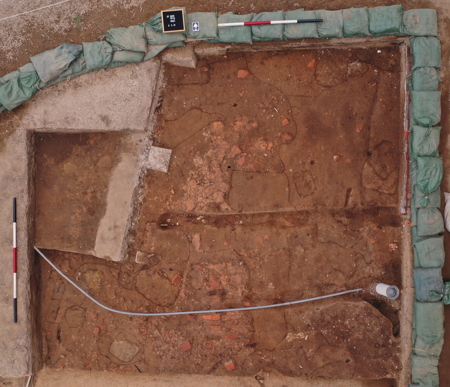
- A scored record shot of the units west of the Chruch Tower. After this photo was taken, we were able to start removing the brick pathway.
-
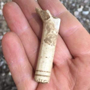
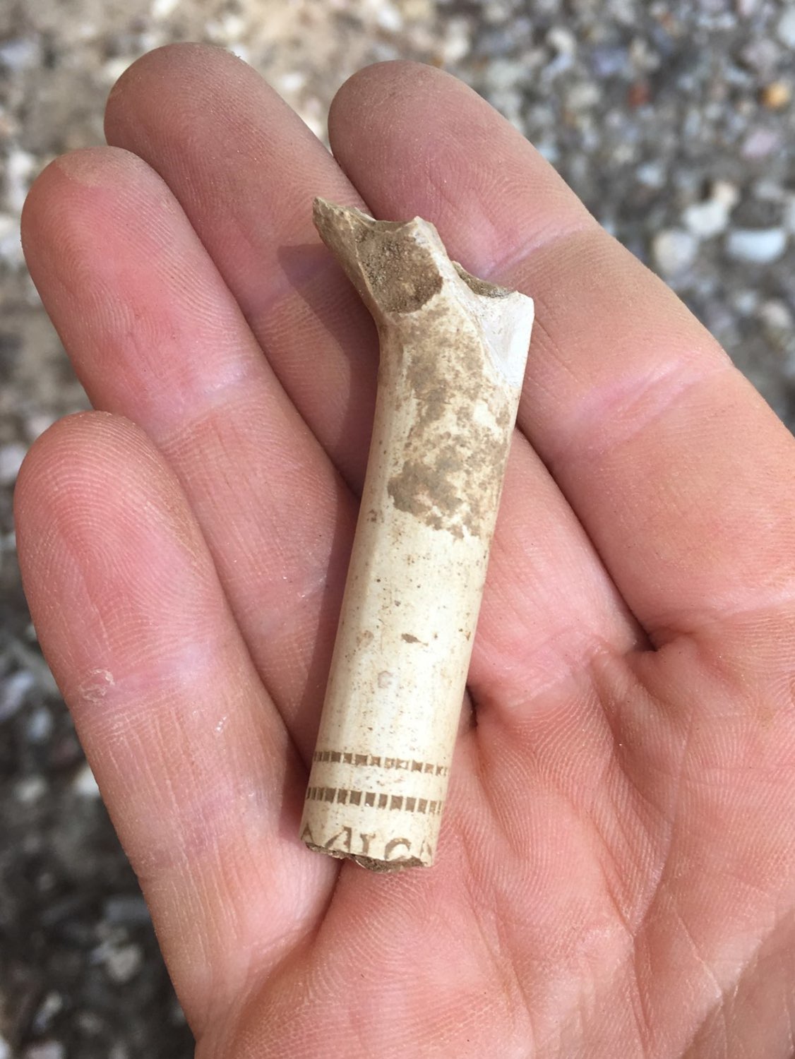
- A decorated pipe stem found in the units west of the Church Tower. The tops of two letters along with a variety of imprinted designs are visible.
-
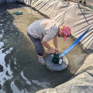
- Anytime a significant amount of water collects in our tarps after rain, we must pump it out in order to open up and continue excavations.

-
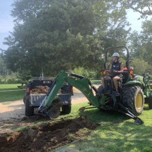
- Archaeologists operate the backhoe to quickly remove the backfill in the new unit located north of the Church Tower. While the majority of the dirt is scooped out, the sidewalls and very bottom are completed with shovels.
-
- A drone shot of the brick foundations in their entirety. After the removal of each section, the bricks and surrounding area were cleaned for further record shots.
-
- The brick foundations after the semi-circular rubble along the outside was removed.
-
- A record shot after the removal of the top brick foundation, leaving the possible cellar floor exposed.
-
- A full record shot of the unit after the remainder of the brick foundation and floor was removed.
-
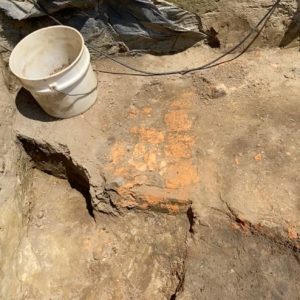
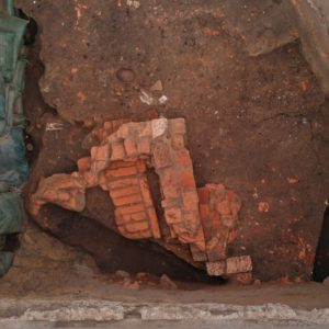
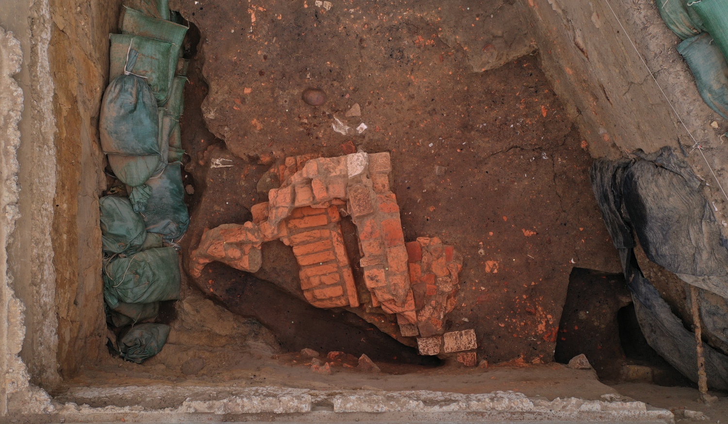
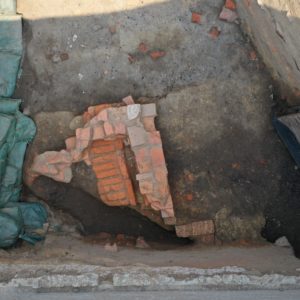
- The foundation (possibly related to the others to the west) that was uncovered in the middle Seawall unit. It was cut to the south by a modern feature likely related to the construction of the Seawall, giving us a free look at the profile.