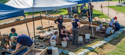
April showers have not stopped the team from making progress across the site! We are starting to excavate some exciting layers down at the Seawall and the Ditch 8 excavations are beginning to come to a close.
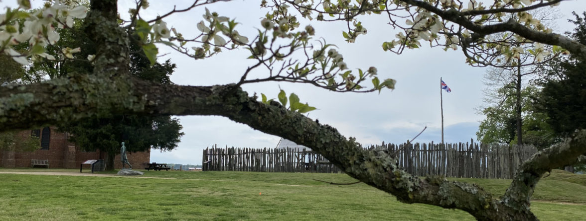
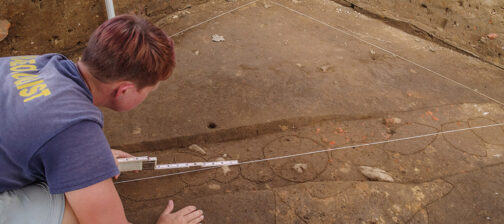
Our last task at Ditch 8 before backfilling is to finish up our tests into three of the ditches running throughout the site. Since ditches are typically filled with trash when they fall out of use, we were excited to see what types of artifacts would come out of the fill. Unfortunately, it appears that a large portion of these ditches was removed during the Civil War during the construction of Fort Pocahontas directly atop James Fort. The landscape around our current excavation site was graded down in order to build up the earthworks, meaning the upper portions of these ditches were disturbed and moved elsewhere.
As these ditches were likely used as property boundaries throughout the 17th century, any artifacts that can give us an idea of when these ditches were dug and how long they were open will allow us to distinguish changes in the landscape through time. Ideally, we would be able to narrow down our date ranges enough to match up each parcel of land with its owner through surviving primary records.
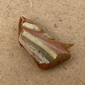
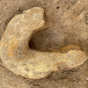
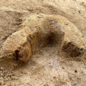
While the lack of artifacts is slightly disappointing, there is just enough coming out of the ground to hold our attention. Our middle test, investigating the intersection of two ditches (JR4613 and JR4614), has revealed a few interesting artifacts. Most notable is a large sherd of a lead-glazed redware, possibly a piece of Jamestown Potter. This ceramic was removed from Ditch JR4614B.02, the most recent of the two ditches. The older ditch, JR4613, contained a small sherd of werraware along with a possible horseshoe.
One of our other tests into JR4614 uncovered a small post hole, possibly for a fence associated with the ditch. Extending down only 2″ before bottoming out, it is likely that any other post hole fill associated with this feature was graded away along with the ditch fill during the Civil War, so we do not know how deep this post would have been. After removing the remaining fill of the post hole, the rest of the ditch fill was taken out. Our next step for this test is to extend it a few feet to the northwest, excavating the very end of the ditch. Visible at the surface of this section is a decent-sized chunk of ceramic, possibly a piece of Italian marble slipware. It is difficult to identify while covered in the ground covered with dirt, so we will know more once it is removed.
Our third test, examining Ditch JR4612, has not had much of a yield in artifacts, though the layers of fill have been interesting. Multiple layers of wash have been identified among purposeful fill, leading us to believe that there were multiple iterations of the ditch throughout time. After partially filling or being washed in, a new iteration of the ditch would be dug to continue marking the boundary.
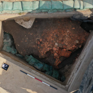
Excavations have also been continuing over by the Seawall. A couple months ago, a portion of a dry-laid foundation was uncovered in the western-most unit. After removing more soil around the brickwork, it appears that we may actually have the far corner of a cellar floor. The bricks still in place may belong to a staircase leading down into the cellar. An exciting find, we have the very northwest portion of the cellar uncovered in the test unit. The rest of the building runs out to the east under the Seawall, and any portions to the south were likely eroded away by the James River over the past four centuries. This test unit lies on the old shoreline of the island before the construction of the Seawall in 1902. On the south side of the unit are cliff-like areas where the river had visibly cut into the shoreline, eroding away soil.
Our middle unit at the Seawall has also been moving right along. Despite all of the 20th-century intrusions (Septic tank, Seawall face, another possible utility trench), the team is almost on top of the midden visible in the west and east units. The material being removed currently is likely related to building up the shoreline shortly before the construction of the Seawall.
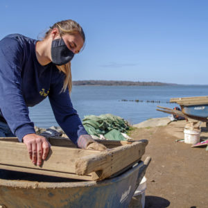
The eastern-most Seawall unit is now fully down on top of the midden, so we are about to change gears in our excavation style. Even our more modern layers on top of the trash pit were artifact-rich, so once we begin digging through the intact midden layers we will begin waterscreening through an 1/8″ screen in case there are small artifacts like beads or fish scales present in the fill. Oftentimes trash pits like wells and cellars will be incredibly artifact-rich, especially in terms of tiny artifacts, so we want to make sure none of those artifacts are slipping through the screens. While we can find much tinier artifacts while waterscreening, it is not as time-efficient as pushing dirt through a ¼” screen which is why we reserve it for contexts that are much more likely to hold those tiny artifacts. Since we were already finding a bunch of ceramics higher up, including 17th-century ceramics, we are excited to see what we find once we begin excavating the midden.
related images
- A small sherd of werraware from Ditch JR4613. This appears to be the rim of the ceramic, likely a plate.
- Covered in corrosion, this chunk of iron may be part of a horseshoe that was pulled out of Ditch JR4613. We will know more about the artifact once it is cleaned up in the lab.
- The possible horseshoe from a different angle before it was taken out of the ground.
- defaultA drone shot of our western-most Seawall units showing the dry-laid bricks we have uncovered so far. The next step is to remove the brick rubble to the north to see if more brickwork lies below.
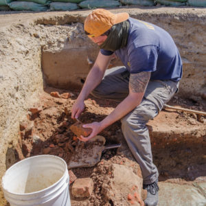
- Staff Archaeologist Nicole Roenicke waterscreens the soil excavated from her unit.
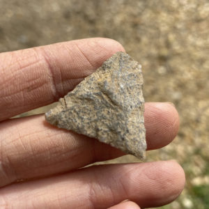
- A partial projectile point found in the fill above the dry-laid foundation.
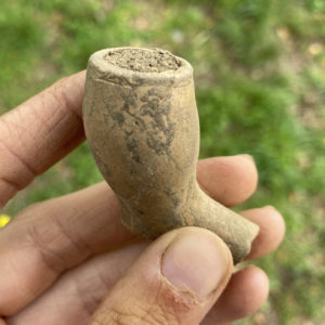
- A locally-made pipe bowl found nearby the dry-laid foundation by the Seawall. Rouletting is visible around the top of the pipe bowl.
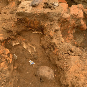
- A photo taken looking east in the test unit with the dry-laid foundation. Plenty of artifacts are visible at the surface of the midden next to the brickwork, including large animal bones, cobbles, and a piece of delftware.
- Staff Archaeologist Ryan Krank excavates the last layer of more modern fill above the 17th-century midden.
- A spread of artifacts found within our eastern-most unit (JR188) by the Seawall. Present are shards of wine and case bottle glass, along with an herbivorous tooth.
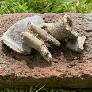
- Sherds of Frechen, a 17th-century stoneware from Germany, that were found above the midden in JR188.
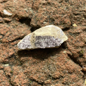
- A sherd of delft found above the midden in JR188. The purple color in the glaze comes from the addition of manganese.
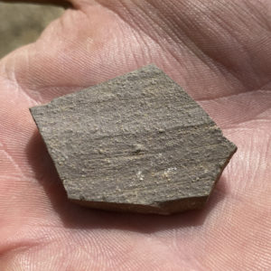
- A sherd of Midlands Purple recovered from JR188 above the midden.
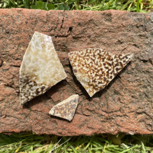
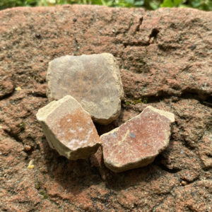
- A sample of redwares recovered from above the midden in JR188.


