Autumn is rolling into Jamestown and the team is absolutely loving the milder temperatures! Since the Dead Shed site has been fully backfilled, everyone is now reunited up by the Fort and excavations are running full speed at both our East Seawall and Ditch 8 excavations.
Thanks to all those who came out for Archaeology Day last month! This fun day included tours and interacting with the staff in celebration of archaeology. We had many visitors and enjoyed a Saturday sharing what we have been working on with the public.
We are still working in three test units at the eastern end of the Seawall, with plans to expand the excavation area in the near future. Since our safety guidelines prohibit us from digging deeper than four feet without a stepped area around it, we will open up more test squares to ensure the safety of the archaeology team. Our excavations along the shoreline are currently around four feet below the ground surface; our team has been removing fill that was purposefully put along the edge of the shoreline in order to reduce the effects of erosion in the area. Once these layers are removed, we will be able to assess how much historic soil is still in place.
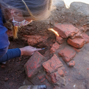
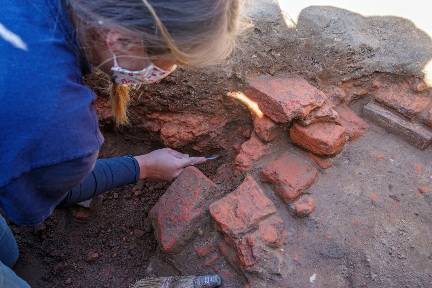
Our most interesting area so far is the western-most test unit. While removing the last layer of fill before the 17th century ground surface, archaeologist Nicole Roenicke uncovered a brick foundation! Only a small portion is visible at this time, and unfortunately the bricks are in poor condition. They were dry-laid (meaning no mortar was used), and because of the eroding shoreline, pieces of the foundation have sloughed off toward the river. At this time, we don’t know exactly what structure these bricks belong to; however, expanding the test unit could lead to uncovering more of the feature and give more answers. It also seems that this structure was built on top of a midden (or a trash pit) from the mid-to-late 17th century. This trash pit may extend through all three of our test units along the bank, and the artifacts within will hold a lot of information about life in the 17th century.
In this same test unit, we were surprised to find a survey nail intact from a previously excavated adjacent area. While it does not sound like the most interesting find, it lets us know that our surveying has been extremely accurate throughout the years. Each of our 10 feet square test units is set on a grid that was established by the Park Service in the 1930s. While setting up our test units, our goal is to get the corners as close as possible (within 0.02 feet) to the established corners on the grid. Finding one of the older survey nails directly in the corner of our new test units proves that we’ve been staying true to the grid all these years.
In the next unit, the team has begun to uncover the east face of the Seawall. While modern layers are still being removed, we have high hopes for what we may find below.
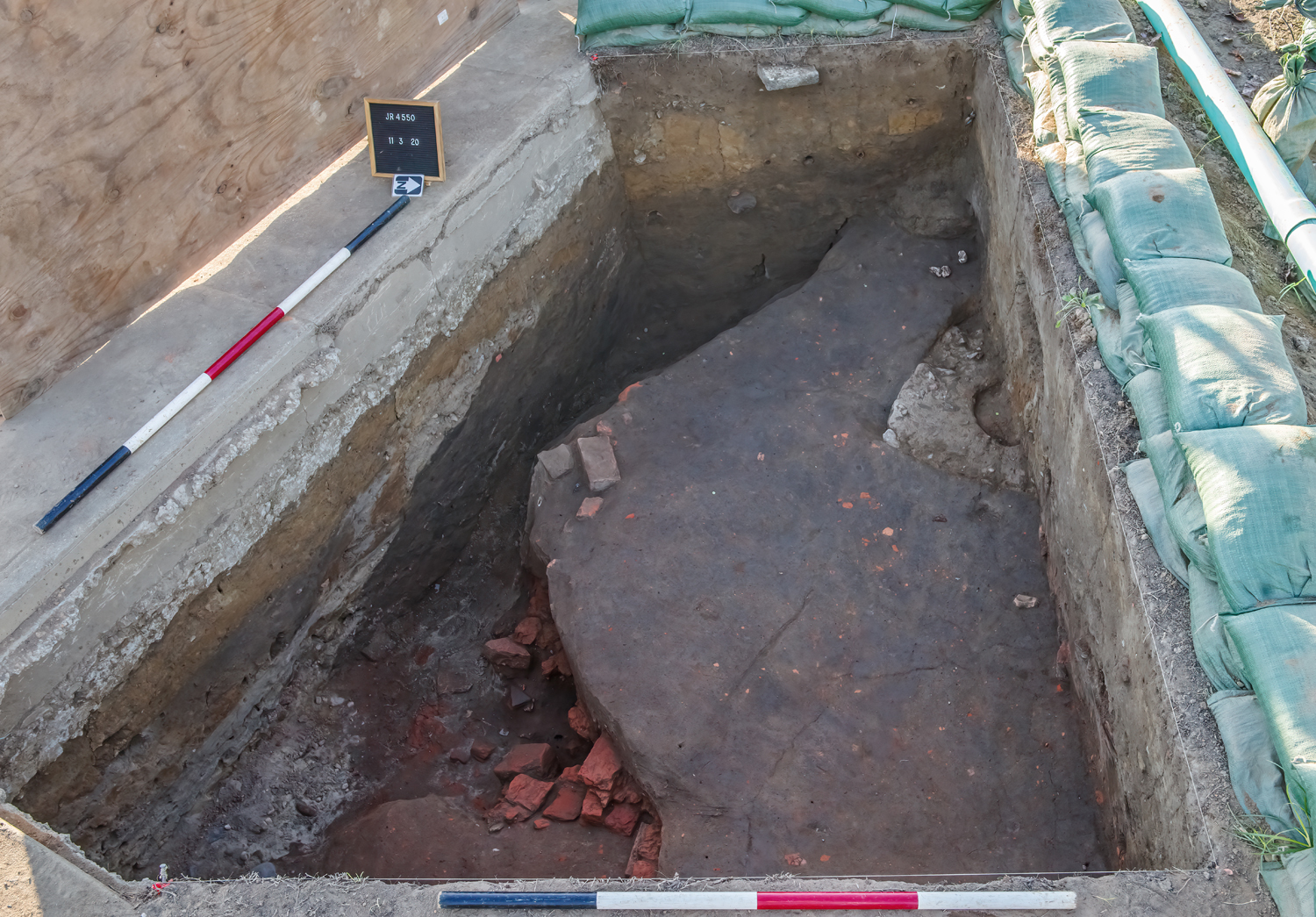
In the last test unit by the East Seawall we just finished removing the backfill from previous archaeological excavations from the early 2000s. Below the fill, the remains of a trash pit (likely the same as the one in the first square) are visible.
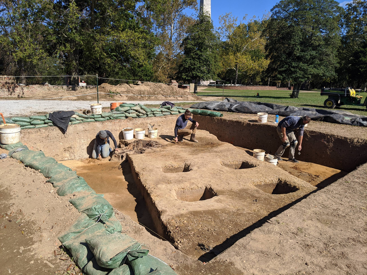
Our excavations are finally underway at Ditch 8! The last bits of backfill from previous excavations were removed, and we have started to work in two of our four test units. We’ve chosen two kitty-corner (diagonally opposite) units so that we can record each profile (map the intact layers) within the unexcavated area. To begin excavations, archaeologists recorded profiles of visible features and cleaned the test units for an opening round of record shots and 3D photography.
Previous excavations tell us we only need to dig through a modern layer of gravel and a layer of early 20th-century landscaping fill to reach the intact features from the 17th century below. Already, we’re starting to pick up traces of features at the bottom of each of the test units: pieces of possible post holes and 17th-century ditches. Once we excavate the last two units, we will have a fuller picture of how the landscape in the area was developed.
We know that this landscaping layer is not intact historic soil due to the fact that we are finding a mixture of artifacts from the 17th-20th centuries. This area had been graded down during the Civil War for the construction of Confederate Fort Pocahontas in 1861. After the APVA acquired the property in 1893 and built the Memorial Church in 1906, a mixture of soil was distributed across the area to build up the landscape. The movement of all this soil leaves behind an assemblage of artifacts from a wide range of time.
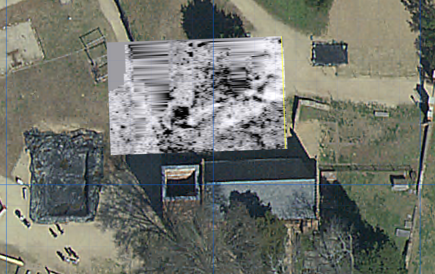
Recently, we have begun surveying the site bit-by-bit with ground-penetrating radar (GPR). These surveys give us an idea of what may lie beneath the surface without putting a single shovel in the ground, and may even lead us to our next excavation area! Since there are acres of land to cover, we’ll survey small sections at a time. Our latest surveys have been located on the north and west sides of the Memorial Church, where so far we’ve found traces of individual post holes from the 1607 wooden palisade, as well as a rectangular pit feature that may be a cellar. Keep checking in with us for more information, as we continue to interpret the data! Here’s a video explaining more about how we use GPR on-site.
related images
-
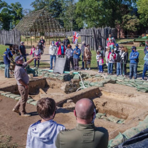
- Director of Archaeology Dave Givens speaks about our Seawall excavations to his tour group on Archaeology Day.

-
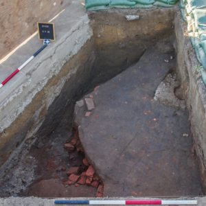
- A dry-laid brick foundation exposed on the historic riverbank at the east Seawall excavation.
-
- Staff Archaeologist Nicole Roenicke excavating and cleaning the dry-laid brick foundation.
-
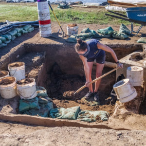
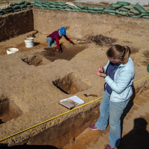
- Site Supervisor Anna Shackelford removing backfilled soil from the previously excavated test unit by the Seawall.
-
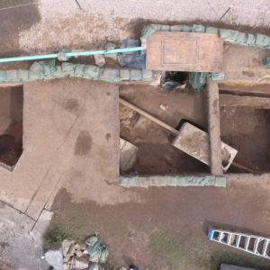
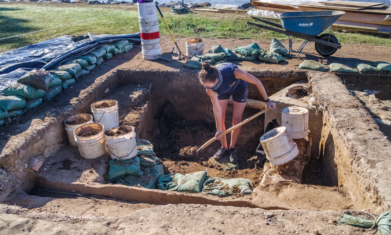
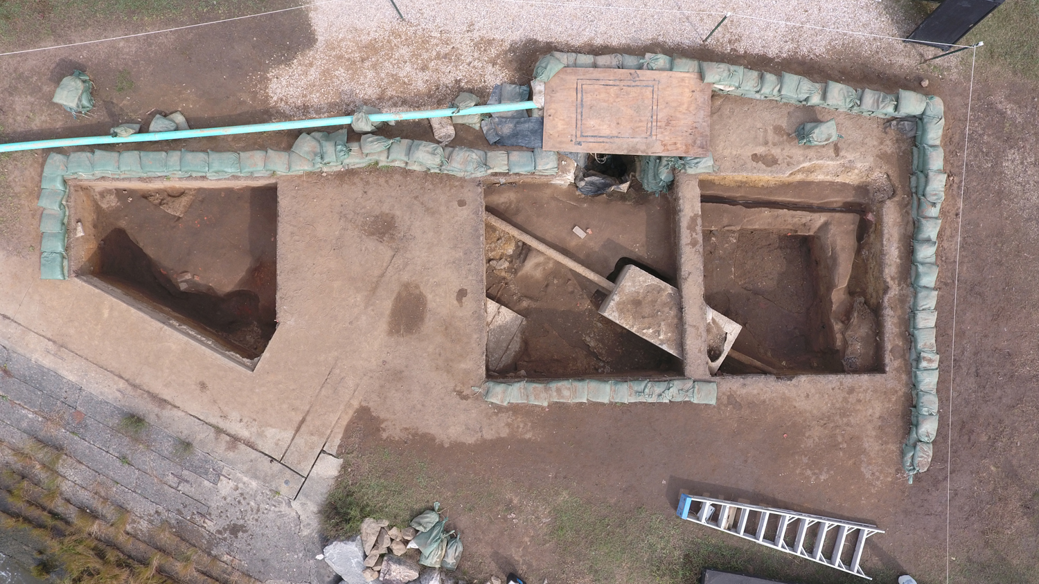
- The three test squares located along the east Seawall. The modern septic tank and sewer lines can be seen stretching through two of our test units.
-
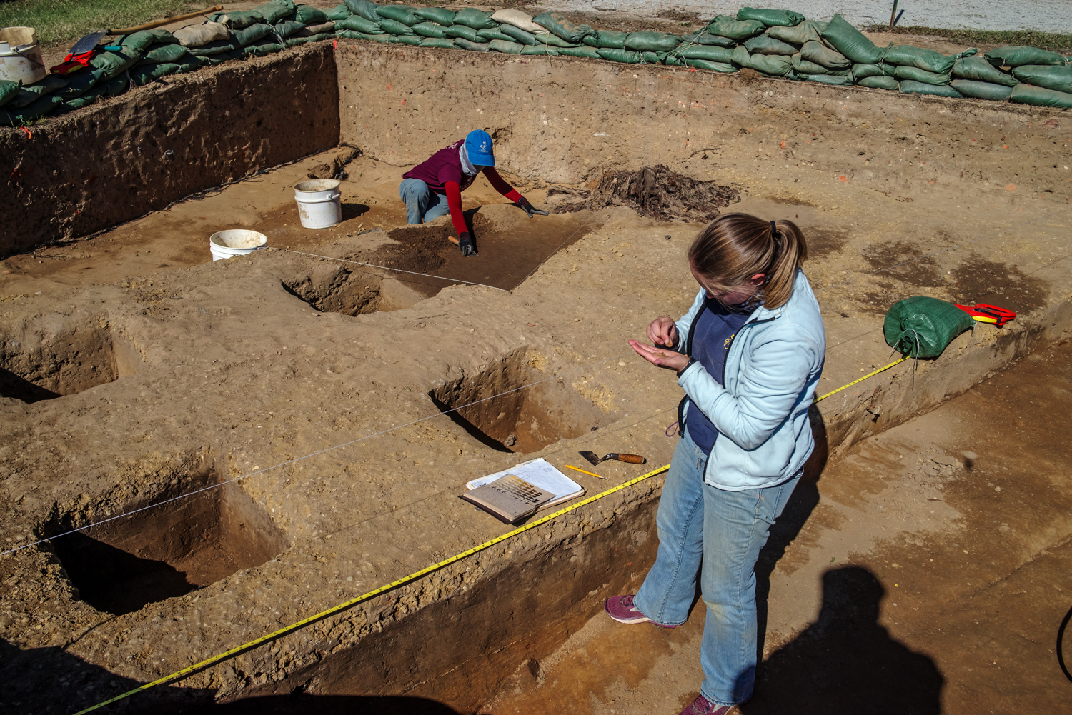
- Field Technicians Natalie Reid excavating and Caitlin Delmas drawing a profile in the Ditch 8 units.
-
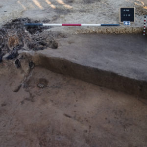
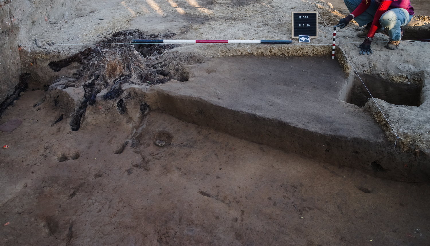
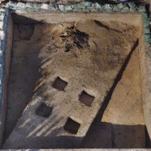
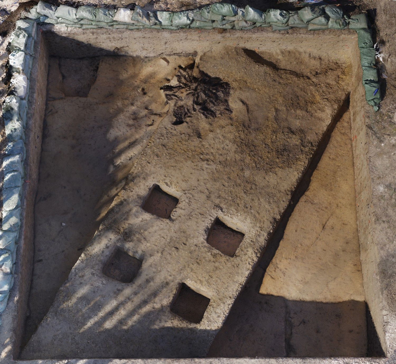
- A record shot taken after the removal of the gravel path in one of our Ditch 8 test units. The next step is to remove the landscaping fill below, as well as the tree stump and affected soil around it.
-
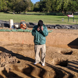
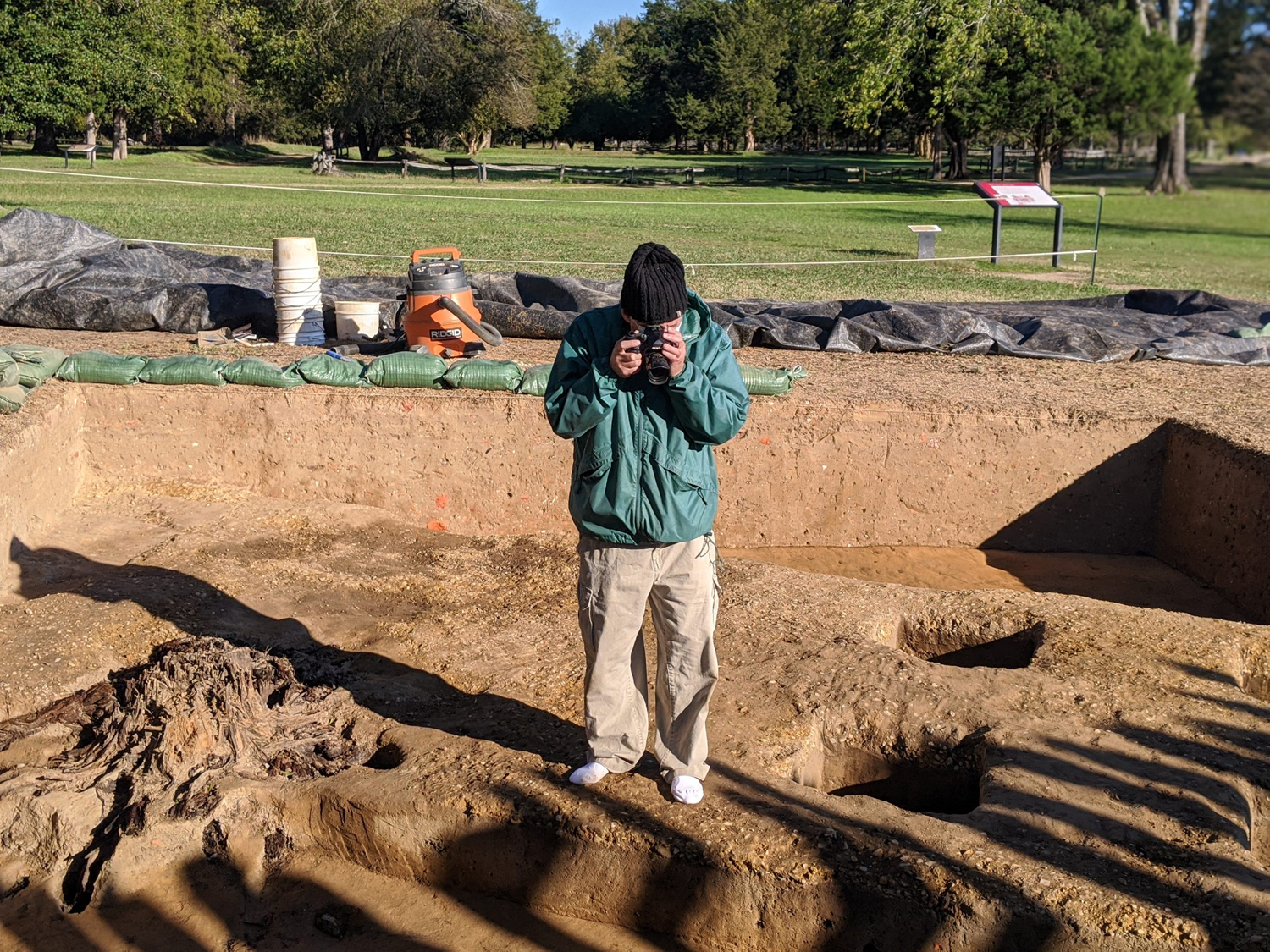
- Chuck Durfor, staff photographer, photographs the Ditch 8 excavation site for agisoft. These photos will be stitched together to create a 3D model of the site.
-
- A screenshot of the completed 3D model created using Agisoft. The data is so accurate, we could use it to map features.
-
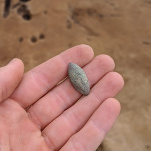
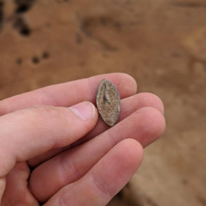
- The front of a possible pin found in the landscaping fill at Ditch 8
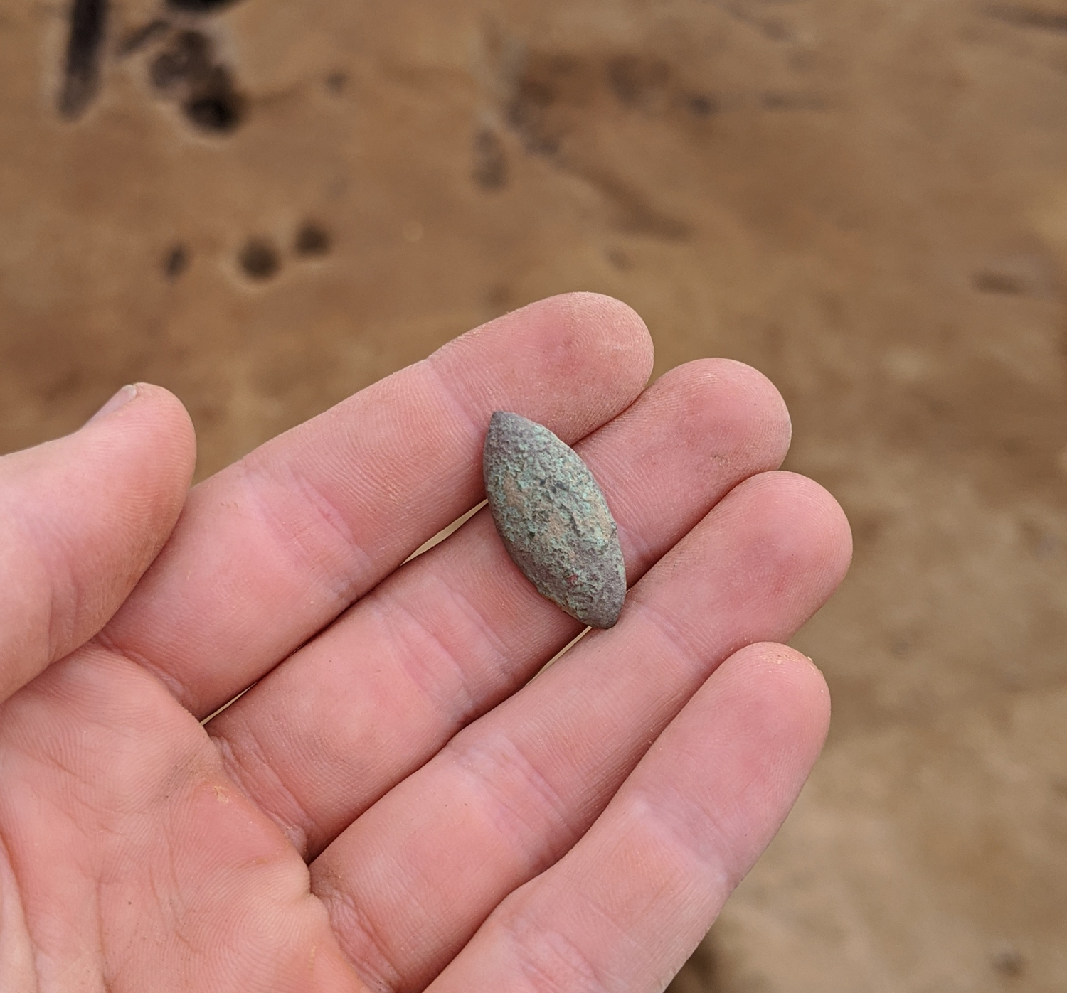
-
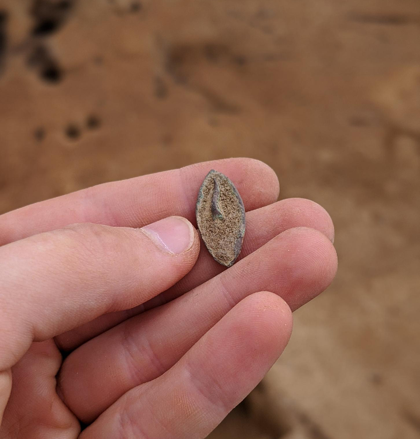
- The back of the same possible pin.
-
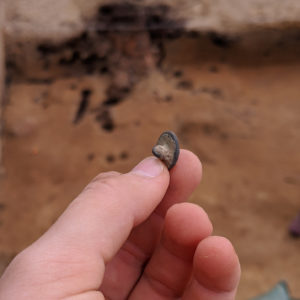
- A copper alloy button found in the landscaping fill at Ditch 8.
-
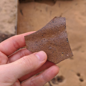
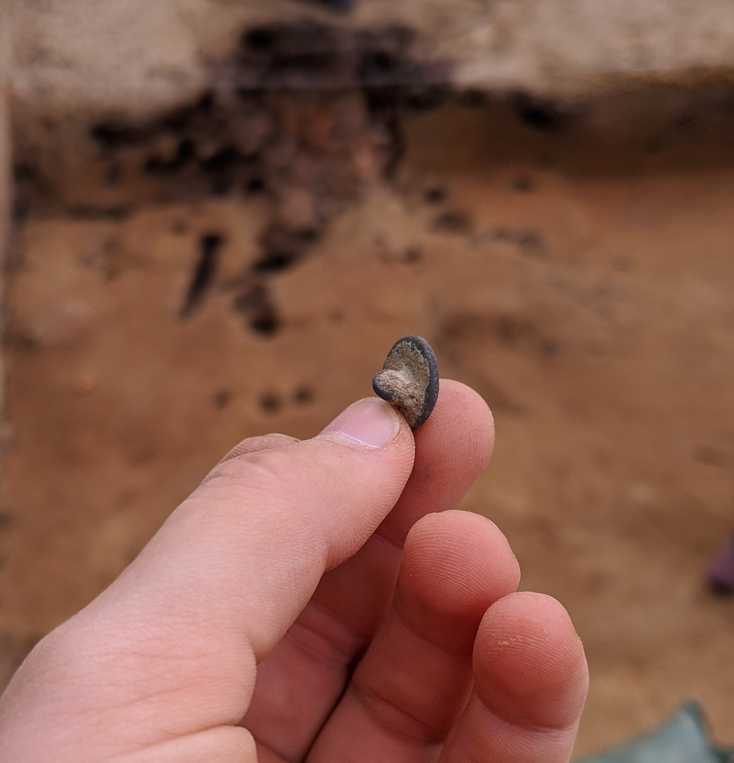
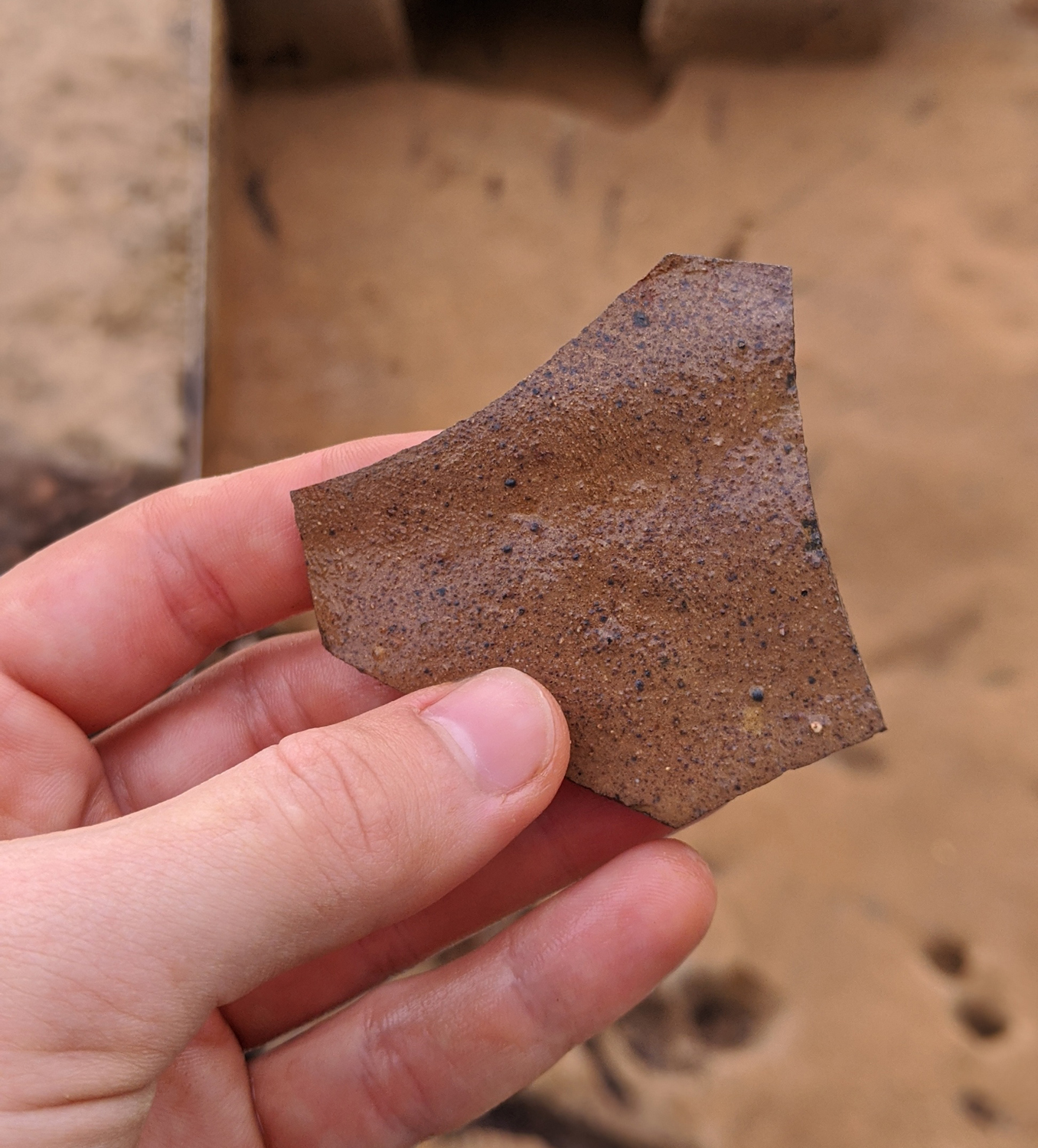
- A large fragment of Midlands purple found in the landscaping fill at Ditch 8.
-
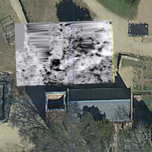
- The results of one of our GPR surveys conducted to the north of the church. Just north of the tower, a section of 1607 palisade is visible as well as a rectangular pit feature.